Route Description
St Cuthbert’s Way is a 62 mile (100km) cross-border route linking the places of interest in the life of 7th century St Cuthbert. The route was opened in 1966 and is rich in history. You walk through attractive and varied countryside between the Scottish Borders town of Melrose and the Holy Island of Lindisfarne which is connected to the mainland by a causeway. The following is intended to provide further information about the route. Please note that all distances and heights in this document are approximate and along with all the other information are provided as an aid to describe the route.
Terrain
The terrain varies from footpaths, farmland, country lanes and rolling moorland.
Waymarking and Navigation
The route is waymarked throughout with the St Cuthbert’s Cross Symbol and is generally easy to follow with the aid of a map and guidebook.
Melrose (height above sea level 85m) to Harestanes (60m).
St. Cuthbert's Way starts at the gates of the magnificent ruin of 12th century Melrose Abbey in the Borders town of Melrose. From Melrose, a steep climb takes you over the saddle (310m) between the Eildon Hills. There are wonderful views in every direction. The route descends to the village of Bowden and leads you through farmland and woodland to Newtown St Boswells. A short walk along the banks of the River Tweed takes you into St. Boswells (90m). You continue along the banks of the River Tweed for a short distance then walk across farmland to follow Dere Street, you will be following in the footsteps of the Romans who built the original road, now a tree lined grassy track across the undulating landscape to Harestanes Countryside Visitor Centre.
Harestanes (60m) to Kirk Yetholm (100m).
You re-join the route at Harestanes and pass Monteviot House then cross the River Teviot. After a short walk along the river you follow paths across farmland and open moor to the village of Cessford and the ruins of Cessford Castle, once the stronghold of the Kers, notorious Border Reivers. The route now follows country lanes through the village of Morebattle (95m). St. Cuthbert’s Way now takes a route over the hills to Kirk Yetholm; this is regarded as the hardest section of the walk. You follow paths as you climb Grubbit Law and cross Wideopen Hill (368M), the highest point on St. Cuthbert’s Way, then Crookedshaws Hill before descending to Kirk Yetholm. Kirk Yetholm is the northern most point on the Pennine Way and you may meet walkers finishing or are about to start the 268 mile route across the rugged backbone of England.
Kirk Yetholm (100m) to Wooler (50m).
The route leaves Kirk Yetholm along a short section of the Pennine Way. You climb and cross the hills (340m) to Hethpool (120m), passing one of many hillforts along St. Cuthbert’s Way and crossing the border from Scotland into England. At the border you will cross into Northumberland National Park, one of Britain’s best kept secrets. Then it’s on through woodland and a good track along the Cheviot foothills. The route rises to 340 metres and you cross the hills to the small market town of Wooler, where you will find shops, cafes and pubs.
Wooler (50m) to Fenwick (40m).
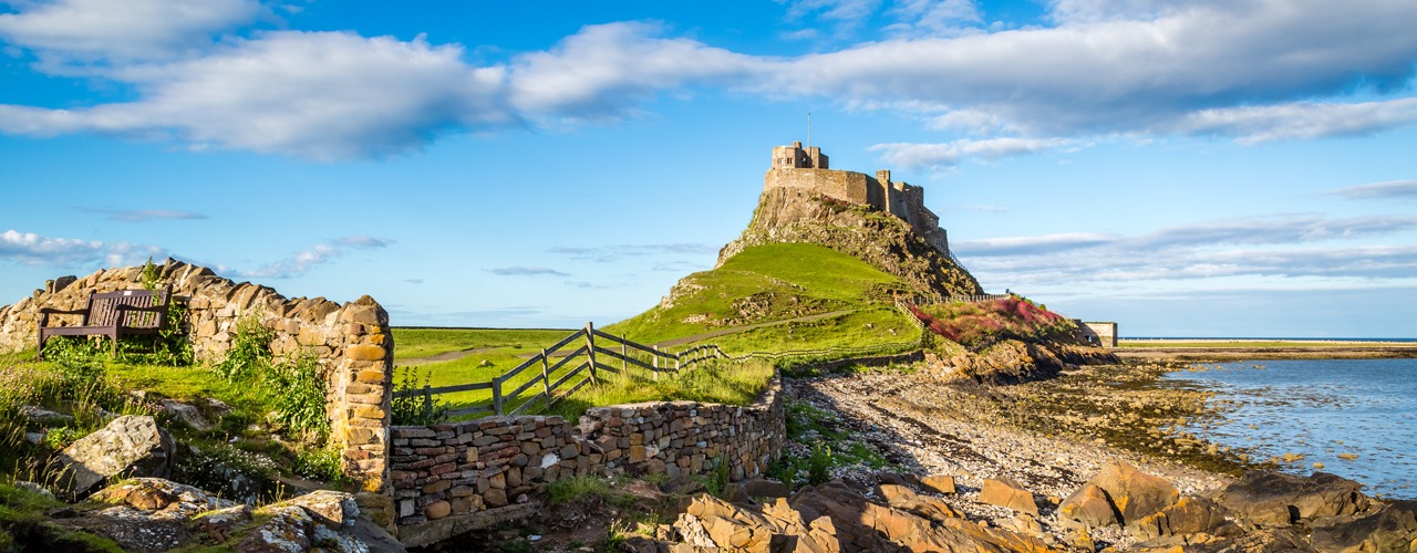
Between Wooler to Fenwick the terrain is easier as St Cuthbert’s Way crosses rolling hills. You leave Wooler and follow paths over Weetwood Moor (150m), quiet lanes then lead to Horton. Paths and tracks lead across farmland to woodland owned and managed by the National Trust. Here you will find St. Cuthbert’s Cave, a sandstone cave where monks took St. Cuthbert’s body in 875AD as they fled from repeated Viking raids on Lindisfarne. After a short uphill walk you get your first view of Holy Island and Lindisfarne Castle. The route leads you into woodland and onto the village of Fenwick. There is a scattering of nearby accommodation.
Fenwick (40m) to Holy Island (15m).
From Fenwick it is a few miles across farmland to the Causeway, which can be crossed at low tide to Holy Island. Plan your day so you arrive to walk over to the island when the tide is out and it is safe to cross. Having reached the Causeway you can either cross via the Causeway Road or follow the posts of the historic Pilgrims Path across the sands. Once on the island it is a short walk to the village and the end of St. Cuthbert’s Way. Here you can see the ruins of the Priory and view Lindisfarne Castle.
More Information?
For more information or to make an enquiry, please don't hesitate to call or email us.


