Route Description
The 79 mile Great Glen Way follows a route across Scotland from Fort William to Inverness. The Great Glen is Scotland’s longest glen and was formed by the Great Glen fault, which divides the Northwest Highlands from the Grampian Mountains. From Fort William to Inverness the Great Glen Way takes you through beautiful landscapes and past historic buildings. The following is intended to provide further information about the route. Please note that all distances and heights in this document are approximate and along with all the other information are provided as an aid to describe the route.
Terrain
The terrain varies from tow paths, good woodland footpaths and rolling hills.
Waymarking and Navigation
The route is sensibly waymarked and generally easy to follow with the aid of a map and guidebook.
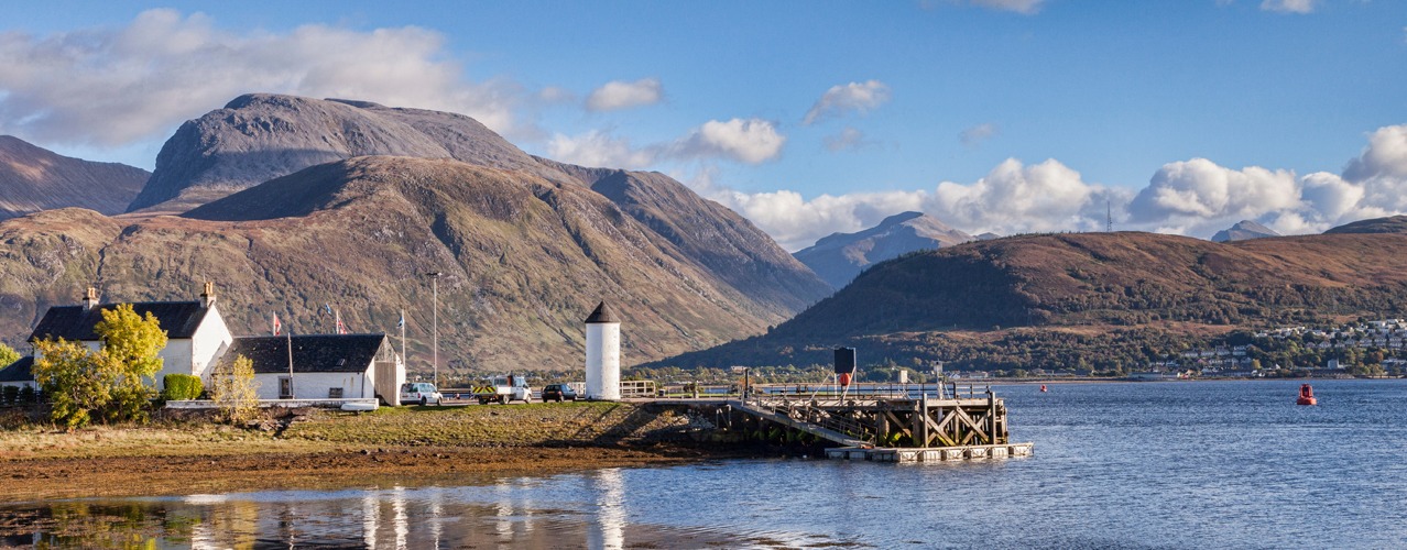
Fort William (height above sea level 10m) to Gairlochy (30m).
The Great Glen Way starts at Fort William, a town on the shore of Loch Linnhe. The route out of Fort William takes you past the ruins of the 13th century Inverlochy Castle and onto the embankment of the Caledonian Canal. You follow the canal to the spectacular Neptune's Staircase, a tightly packed series of eight locks that raise the canal 64ft/20m. There are wonderful views of Ben Nevis. The route continues on a good path alongside the canal to Gairlochy.
Gairlochy (30m) to Laggan (30m).
The Caledonian Canal meets Loch Lochy and you follow clear paths and forest tracks close to the shore of Loch Lochy. The Loch is said to be inhabited by a monster known as ‘Lizzie’. This is Clan Cameron territory and it is possible to take a detour to the Clan Cameron museum at Achnacarry. The route follows the Loch for approximately 10 miles to the next section of the Caledonian Canal at Laggan Locks.
Laggan (30m) to Fort Augustus (20m).
The route follows a short section of canal which links Loch Lochy to Loch Oich. The 4 mile route alongside the Loch follows the course of an old railway line and stretches of General Wade’s military road. You arrive at the next section of the Caledonian Canal and the Great Glen Way follows the canal side path to the locks at Fort Augustus. Fort Augustus lies at the southern end of Loch Ness, home of the legendary Loch Ness Monster, ‘Nessie’.
Fort Augustus (20m) to Invermoriston (30m).
This relatively easy section can be combined with the stretch from Laggan to Fort Augustus to create a ‘full day’s walk’. The route leads through Fort Augustus and a short climb brings you to a forest track. You follow paths and forest tracks above the shore of Loch Ness to Invermoriston. There is also an alternative high level route which climbs above the forest and offers more expansive views.
Invermoriston (30m) to Drumnadrochit (30m).
The Great Glen Way continues to follow mainly forest tracks alongside Loch Ness from Invermoriston to Drumnadrochit. For the last section the route drifts away from Loch Ness and picks up the path of a minor road. As you approach Drumnadrochit you can detour to visit the ruins of Urquhart Castle, on the shore of Loch Ness. The 13th century castle was once one of the largest castles in Scotland. There is also a high level optional route from Invermoriston to Drumnadrochit.
Drumnadrochit (30m) to Inverness (10m).
This is the longest and section along the Great Glen Way. You leave Drumnadrochit along the road and join the tracks through the forest. The tracks leave Loch Ness and climb to the highest point on route, 380M, in Abriachan Forest. You follow the course of an old drove road passing Blackfold. The route descends back into the Glen on the outskirts of Inverness. You cross the Caledonian Canal and then follow a path alongside the Rover Ness to finish at Inverness Castle.
More Information?
For more information or to make an enquiry, please don't hesitate to call or email us.
