Route Description
The following is intended to provide some further information about the route and points of interest. Please note that all distances, timings and heights are approximate and along with all the other information are provided as an aid to describe the route. The time to cover the distance includes time spent walking and time for breaks. If further information is required please contact our office. Several guide books providing detailed route descriptions and information are also available.
Terrain
The terrain varies from lowland moors, woodland, rolling hills, to high mountainous regions in the Scottish Highlands.
Day 1 - Milngavie.
Arrive at your accommodation. Meet your guide and fellow walkers at the welcome meeting in the evening.
Day 2 - Milngavie (Height above sea level 50m) to Drymen (50m).
Distance 12 miles - Moderate - Height Gain 200m/655ft - 6 hours
The official start of the West Highland Way is a granite obelisk in Douglas Street, Milngavie. The Way leaves the town centre and enters Mugdock Country Park. On leaving the park the route continues northwards on good paths through rolling farmland. We continue along the route to our accommodation in Drymen.
Day 3 - Drymen (50m) to Rowardennan (20m).
Distance 15 miles - Long moderate - Height Gain 500m/1635ft - 7 hours
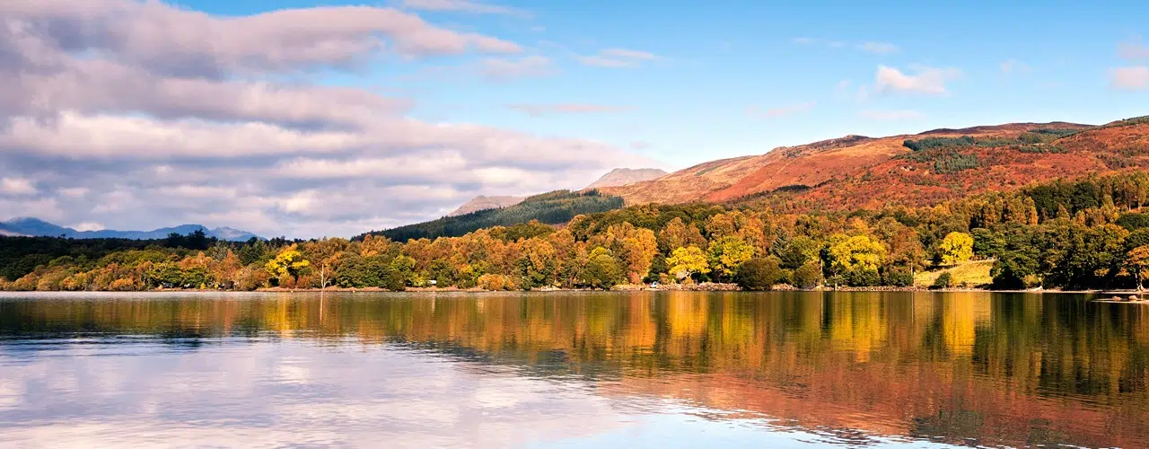
The Way enters Garadhban Forest and follows a forest track for a few miles. Upon leaving the forest we follow the path as is climbs almost to the summit of Conic Hill (360m), on a clear day there are wonderful views over Loch Lomond. The Way then descends to Balmaha, and passes the National Park Centre. We follow a woodland walk along good paths or tracks as the Way runs close to the eastern shore of Loch Lomond to our accommodation at Rowardennan.
Day 4 - Rowardennan (20m) to Inverarnan (30m).
Distance 14 miles - Moderate - Height Gain 350m/1145ft - 7 hours
From Rowardennan the Way follows forestry tracks through countryside, once inhabited by Rob Roy, to Inversnaid. The Way then continues along the side of the loch but the going is more difficult and the path for the next few miles is regarded as one of the toughest sections of the Way. Two miles before Inverarnan the going is much easier. The historic Drovers Inn at Inverarnan is a great favourite with its selection of beers and whiskies. It is well worth a visit, if only to see the collection of stuffed animals and birds.
Day 5 - Inverarnan (30m) to Tyndrum (225m).
Distance 12 miles - Moderate - Height Gain 500m/1635ft - 6 hours
The Way continues along good paths and tracks, much of which is an old military road. This is the gateway to the Highlands and the Way gains height as it leaves the Loch Lomond basin and rises to 250m. From Crianlarich (180m) we continue along good paths and tracks with some moderate descents and ascents to Tyndrum.
Day 6 - Tyndrum (225m) to Kingshouse (250m).
Distance 19 miles - Long moderate/Strenuous - Height Gain 600m/1960ft - 8.5 hours
This is the longest day of the holiday. The Way continues for 7 miles along good paths and tracks following the line of an old military road to the Bridge of Orchy. The route crosses the bridge and climbs a small hillock (310m) with some superb views all-round. There is good going underfoot as you cross Rannoch Moor, one of Britains largest and wildest moors. The path climbs steadily to its high point at 450m before descending to Kingshouse.
Day 7 - Kingshouse (250m) to Kinlochleven (20m).
Distance 9 miles - Strenuous - Height Gain 350m/1145ft - 5 hours
The Way follows the route of an old military road. 3 miles beyond Kingshouse the Way climbs steeply up the Devils Staircase. At 550m this is the highest point on the Way. There is now a long descent into Kinlochleven.
Day 8 - Kinlochleven (20m) to Fort William (10m)
Distance 15 miles - Strenuous/Moderate - Height Gain 500m/1635ft - 7 hours
In the first mile the Way zigzags steeply up the hillside to meet an old military road (250m). The highest point on todays route is Lairigmor, the high pass (330m), though there are no more serious gradients as the route continues on good paths with high mountains on both sides. The final stretch is through Nevis Forest, with Ben Nevis (1344m) the highest mountain in the British Isles, visible through breaks in the trees. The Way descends into Glen Nevis and follows a road for the final 1.5miles to Fort William and the end of a wonderful route.
Day 9 - Fort William
After breakfast depart for home, but first you might like to take time to explore Fort William, the largest town in the west Highlands of Scotland. It is surrounded by magnificent scenery and has an important history. There are high mountains, lochs, beautiful glens, forests and beaches in between. This is a huge outdoor playground which caters for a wide range of activities. Fort William is an excellent location to spend an extra day or more. There is a wealth of on land, and on water activities. Many people stay a day longer just to climb Ben Nevis. Please contact us if you require further information.
More Information?
For more information or to make an enquiry, please don't hesitate to call or email us.
