10 Nights Accommodation/9 Days Walking
- Day 1 Travel to Kirkby Stephen where your first nights accommodation is booked
- Day 2 Kirkby Stephen to Keld - 13 miles (21km)
- Day 3 Keld to Reeth - 11 miles (18km)
- Day 4 Reeth to Richmond - 11 miles (18km)
- Day 5 Richmond to Danby Wiske - 14 miles (22km)
- Day 6 Danby Wiske to Ingleby Cross – 8.5 miles (14km)
- Day 7 Ingleby Cross to Clay Bank Top – 12.5 miles (20km)
- Day 8 Clay Bank Top to Blakey Ridge – 8.5 miles (14km)
- Day 9 Blakey Ridge to Grosmont – 13.5 miles (22km)
Route Description
Kirkby Stephen
For travel information to Kirkby Stephen, view our Travel Page or contact us for further information.
Check in to your first night’s accommodation. The market town of Kirkby Stephen serves as the mid-point stop on Wainwright’s famous Coast to Coast.
Kirkby Stephen (180M) to Keld (350M). Distance 13 miles (21km)
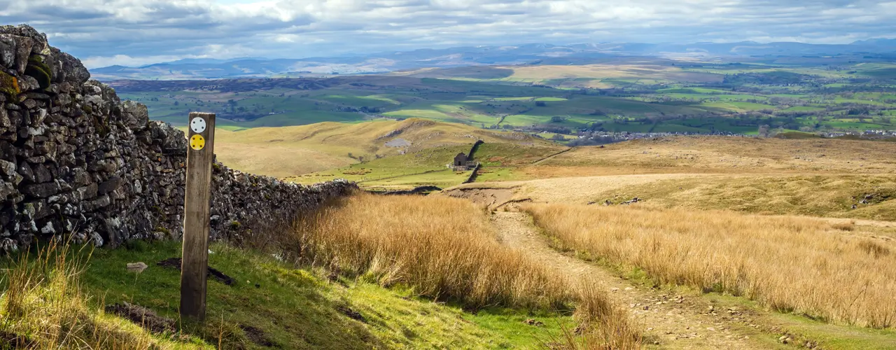
Cross Franks Bridge and head for the lane which becomes a broad path onto the Pennine Moors and the summit of Nine Standards Rigg (662M). The National Trail now follows the improved path from Nine Standards and over White Mossy Hill, this was designated as the Red Route (May to July). The route passes through Ravenseat Farm before descending to the River Swale and the road into Keld.
Keld (350M) to Reeth (200M). Distance 11 miles (18km)
From Keld you have a choice of routes. The high route crosses moorland that is scarred from a lead mining industry that disappeared at the end of the 19th century. The lower ‘Royal route’ follows paths through Swaledale valley.
For the high route - from Keld the route descends to the river then climbs past Crackpot Hall and the ruins of Swinner Gill mine workings. It crosses the moor (580M) before dropping into Gunnerside Gill (400M) and then up onto Melbecks Moor (550M). From here a broad track descends gradually passing the ruins of Old Gang Smelting Mills to Surrender Bridge (350M) and another smelt mill. The last test of the day is to drop into Cringley Bottom, cross the river and then continue over the farmland to Reeth.
For the low route – from Keld head towards Crackpot Hall. Shortly before the Hall turn right, descend to the river and follow the path towards Muker village (250M). Shortly before Muker turn East alongside the River Swale to Gunnerside (240M) village. The path leaves the river and climbs to 390M then contours round the hillside gradually descending to 300M above Feetham. The route continues along paths and a lane to the hamlet of Healaugh (210M). From here it’s a 2km riverside walk to Reeth.
Reeth (200M) to Richmond (150M). Distance 11 miles (18km)
This is a much easier day’s walk across rolling countryside passing Marrick Priory, Marske village and Whitecliffe wood to the largest town on route, Richmond.
Richmond (150M) to Danby Wiske (36M). Distance 14 miles (22km)
The route to Danby Wiske is almost level and easy going, it crosses farmlands to Bolton on Swale and then continues along paths and lanes across the low-lying Vale of Mowbray.
Danby Wiske (36M) to Ingleby Cross (80M). Distance 8.5 miles (14km)
The path remains easy going, it continues along paths and lanes across the Vale of Mowbray. The approved route does not cross the A19 at Ingleby Arncliffe. Instead the signed route goes north to cross the A19 via the Black Swan Bridge, it then turns south to Ingleby Arncliffe village, this route is approx. a 4 mile/6km diversion. If you decide to follow the much shorter old route take care crossing the busy A19 road to Ingleby Arncliffe village.
Ingleby Cross (80M) to Clay Bank Top (250M). Distance 12.5 miles (20km)
This is the start of the crossing of the Cleveland Hills and the North York Moors, which are covered in purple heather during late summer months. If you are staying in Osmotherley (160M) leave the wood and follow the Cleveland Way down to the village, if not continue on to Clay Bank Top. The route follows the Cleveland Way trail and climbs steadily over Beacon Hill (299M) then descends into Scugdale (100M). The path climbs steadily at first then steeply onto Gold Hill (315M). It continues onto Carlton Moor (408M) before descending to Green Bank (300M). Once again, it climbs going over Cringle Moor (430M), descends to 280M back up to 400M, down again to 300M and then a final climb through the Wainstones onto Hasty Bank (398M) before descending to the road at Clay Bank Top (250M). If all the up and down seems like too much hard work, there is a path that contours round the hills from Green Bank to Clay Bank Top. There is no accommodation in Clay Bank Top, therefore you are transferred from here to accommodation in nearby villages.
Clay Bank Top (250M) to Blakey Ridge (400M). Distance 8.5 miles (14km)
You are transferred from the accommodation to Clay Bank Top. There is a steep ascent to Carr Ridge (390M) followed by a gradual rise to the summit of Round Hill (454M), the highest point on the North York Moors. The path descends to Bloworth Crossing (400M) where it leaves the Cleveland Way and continues on an almost level disused railway line across the desolate moors to the remote Lion Inn on Blakey Ridge.
Blakey Ridge (400M) to Grosmont (50M). Distance 13.5 miles (22km)
The route follows an old toll road through the private estate of Egton Manor to Grosmont.
Grosmont (50M) to Robin Hoods Bay. Distance 15 miles (24km)
The road climbs steeply out of Grosmont to its high point on Sleights Moor (285M), there are wonderful views to Whitby and the sea. Still on heather moorland the route descends into Littlebeck (50M). The route follows a woodland trail. After the woodland it climbs up to 200M and crosses a final stretch of heather moorland before following country lanes to the coast. This time the path turns south to follow a coastal path to Robin Hoods Bay and a final last descent to the sea. Follow tradition once more by dipping your boot in the sea and throwing in your pebble. Your challenge is complete.
Robin Hoods Bay
After breakfast, depart your last night’s accommodation. Robin Hoods Bay is a picturesque former fishing village and smuggler’s haunt, and it is well worth exploring if you have time.
For travel information from Robin Hoods Bay, view our Travel Page or contact us for further information.
Booking
Our self guided holidays are booked on an individual basis and therefore you can start your holiday on any date of your choice between April and early October.