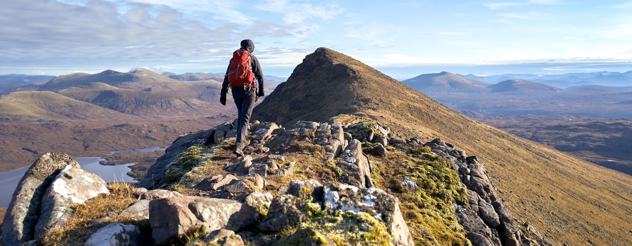
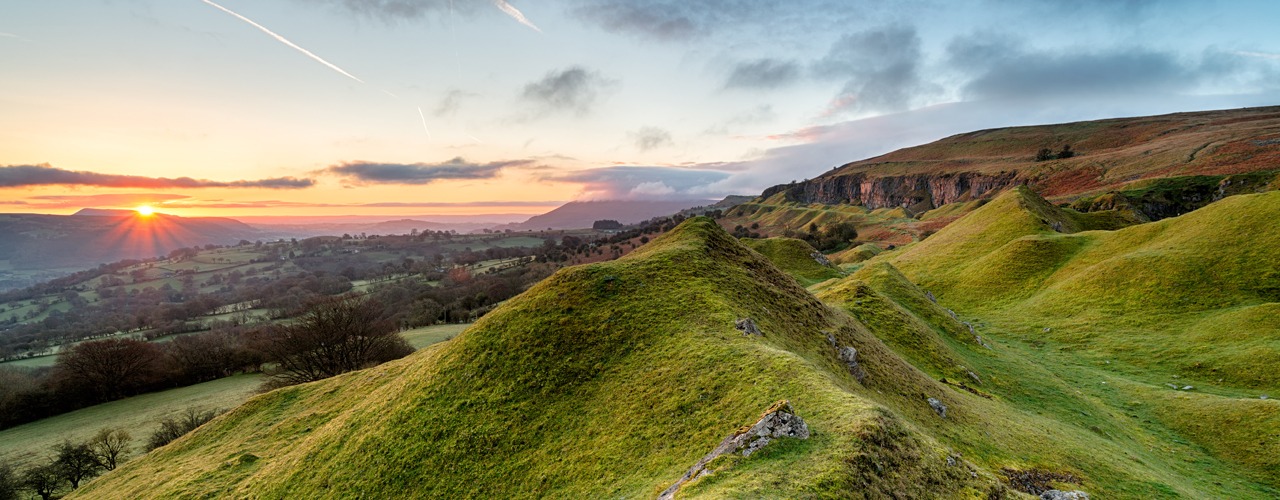
- Guided Walking Holidays
-
Guided Walking Holidays
Guided walking holidays on Wainright's Coast to Coast and the West Highland Way.
-
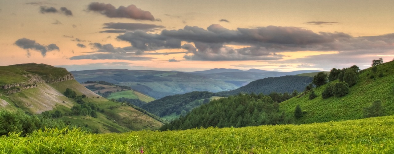
- Self-Guided Walking Holidays
-
Self-Guided Walking Holidays
Self-Guided walking holidays on some of the UK’s most popular routes.
-
- FAQs
- Make Booking
- Contact Us
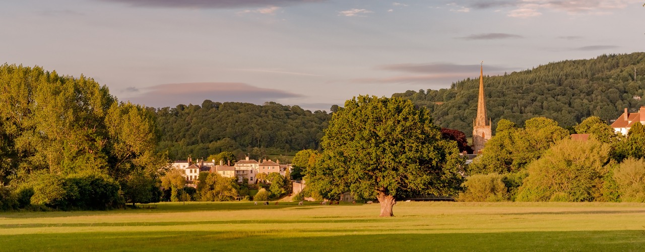
Northwestwalks, for walking holidays you can trust
-
8 Nights Accommodation/7 Days Walking
-

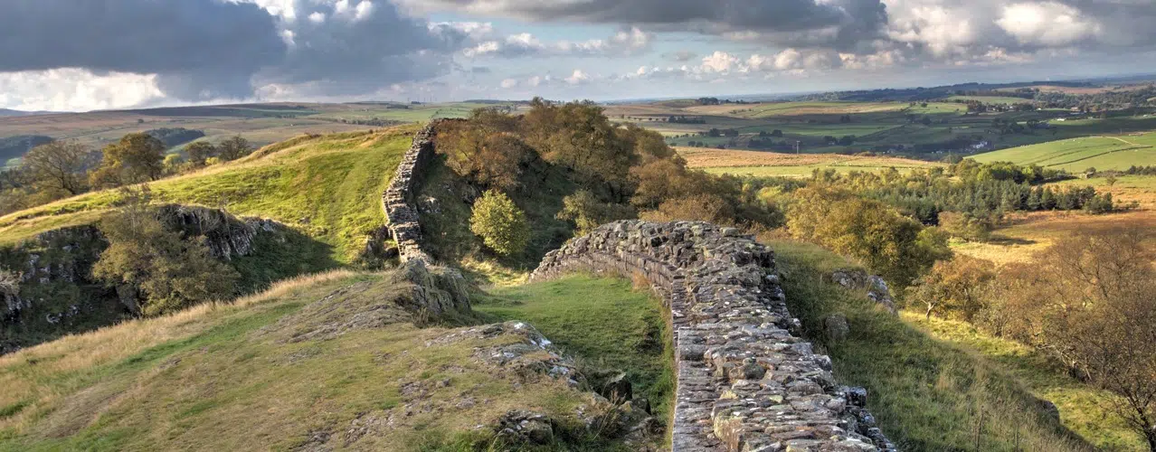
Hadrian's Wall West to East
8 Nights/7 Days Itinerary- 8 Nights Accommodation
- 7 Days Walking
- Total distance 84 miles
8 Nights Accommodation/7 Days Walking
- Day 1 Travel to Bowness-on-Solway where your first nights accommodation is booked
- Day 2 Bowness-on-Solway to Carlisle - 15 miles
- Day 3 Carlisle to Newtown - 8 miles
- Day 4 Newtown to Gilsland - 11 miles
- Day 5 Gilsland to Steel Rigg - 8 miles
- Day 6 Steel Rigg to Chollerford - 12 miles
- Day 7 Chollerford to Heddon-on-the-Wall/Wylam - 15 miles
- Day 8 Heddon-on-the-Wall/Wylam to Wallsend - 15 miles
- Day 9 Depart Newcastle for home
Route Description
Bowness-on-Solway (height above sea level 5m) to Carlisle (15m). Distance 15 miles.
Walking West to East, a small shelter and pretty garden in the village of Bowness-on-Solway mark the start of Hadrian’s Wall Path. Not since the end of the Roman occupation of Britain, some 1600 years ago, has it been possible to walk along the entire length of Hadrian's Wall. The route to Carlisle is almost level. The first 7 or 8 miles follow a roadside path alongside the peaceful Solway Estuary. There are wonderful views across the estuary to the hills in Southern Scotland. The path passes through the village of Burgh by Sands (20m) and shortly after follows the River Eden to Carlisle. The border City of Carlisle is close to the Scottish border. The Romans established a settlement here to serve the forts on Hadrian’s Wall. Carlisle Castle is a great medieval fortress which houses the Border Regiment Museum. Carlisle is also at the end of the 70 mile Cumbria Way long distance walking route which crosses the Lake District from Ulverston at the southern end.
Carlisle (15m) to Newtown (70m). Distance 8 miles.
From Carlisle the path alternates from riverside to roadside walking as it makes its way to Crosby-on-Eden (30m). The route leaves the river and you continue across almost level farmland to the village of Newtown (70m). There are no ruins of the wall or forts to be seen on this section of the walk, but the occasional humps and bumps in the ground and glimpse of vallum ditch show the line of the Wall.
Newtown (70m) to Gilsland (130m). Distance 11 miles.
Shortly after leaving Newtown, you pass through the village of Walton (80m) and in a few miles the hamlet of Banks (120m). After Banks there is evidence of Hadrian’s Wall as the path continues across farmland to Birdoswald Fort (open daily from April to September), which is a mile before Gilsland (130m).
Gilsland (130m) to Steel Rigg (280m). Distance 8 miles.
You leave Cumbria and pass into Northumberland. At Greenhead you meet the 268 mile Pennine long distance National Trail, an upland walking route which leads from Edale in Derbyshire to Kirk Yetholm in the Scottish Borders. The landscape changes and at Walltown Crags there are views of southern Scotland and the Northern Pennines, and back to the Solway Firth. Hadrian’s Wall Path climbs onto the Crags and for the next few miles continues its route over the Crags alongside good sections of the Wall. The Wall was built on a line of rocky Crags which created a high defence to potential invaders from the north. There are excellent views of the surrounding area and Northumberland National Park. The path reaches its highest point at Windshields Crags (345m), there isn't very much between yourself and the Shetlands, a wasteland occupied by ‘The Barbarians’, or so the Romans called them, two millennia ago. From Steel Rigg you are approximately 2 miles from Vindolanda Fort, which is open daily from April to September.
Steel Rigg (280m) to Chollerford (100m). Distance 12 miles.
On this stage there are the most complete sections of the Wall, forts, milecastles, turret sections and wonderful views as the Wall crosses the Pennine Hills. For the next several miles the path rises and falls as it crosses the Crags, passing Housesteads Fort (275m). Near milecastle 34 (250m) Hadrian’s Wall leaves the crags and meets the B6318 road, which is dubbed the military road, not on account of the Romans, rather General Wade, builder of military supply roads in the 18th century in response to the Jacobite rebellion. It follows the line of the military road for several miles, descending towards Chollerford (100m). On route the path passes Limestone Corner, the most northerly point of the Wall. At Chollerford there are the ruins of Chesters Roman Fort and Chesters Museum, open daily from April to September.
Chollerford (100m) to Heddon-on-the-Wall (120m). Distance 15 miles.
Shortly after leaving Chollerford the path passes St. Oswald’s Church at Heavenfield (220m), the site of a 7th century battle between Northumbrian forces and an invading Welsh army. The battle was a decisive victory for Oswald, King of Northumbria. The 97 mile St. Oswald’s Way long distance walking route leads from Heavenfield to Holy Island, and Hadrian’s Wall path and St Oswald’s Way follow the same path for the next few miles. The route continues in an almost straight line alongside the military road. At the junction with the A68 road is Portgate (200m), which was the junction with the Wall and Dere Street, the main Roman road into Scotland. The historical market town of Corbridge is a few miles to the south of the path. The route is almost straight and level as it follows the line of the military road, where the Wall once stood, to Heddon-on-the-Wall. On the north side of the road you will see the ditch in places and the occasional ridge in the fields to the south. At Heddon-on-the-Wall is the last section of the Wall.
Heddon-on-the-Wall (120m) to Wallsend (5m). Distance 15 miles.
The route now leads towards the River Tyne. At the river Hadrian’s Wall path turns left towards Newburn and Newcastle, but if you turn right along the Waggonway for a short distance it brings you to Wylam birthplace of George Stephenson. Hadrian’s Wall Path continues alongside the River Tyne to Newcastle. The route leads through Newcastle Quayside, a vibrant area with restaurants and cafes. The bridges, including the tilting Millennium Bridge ('Winking Eye Bridge') link Newcastle to Gateshead. After leaving the city centre the route follows alongside the River Tyne, passing the shipyards and Newcastle’s industrial centre for the last several miles to Wallsend. The end of Hadrian’s Wall Path is at the remains of Segedunum Roman Fort (open Monday to Saturday 10am to 3pm).
Booking
Our self guided holidays are booked on an individual basis and therefore you can start your holiday on any date of your choice between April and early October.
This Holiday Includes
8 nights accommodation with breakfast
Daily luggage transfer between accommodation
Guidebook & route map
Accommodation directions & holiday information
Emergency contact
Holiday price £860 per person based on two people sharing a room. Single supplement £400.
-
Hadrian's Wall West to East
7 Nights/6 Days Itinerary- 7 Nights Accommodation
- 6 Days Walking
- Total distance 84 miles
7 Nights Accommodation/6 Days Walking
- Day 1 Travel to Bowness-on-Solway where your first nights accommodation is booked
- Day 2 Bowness-on-Solway to Carlisle - 15 miles
- Day 3 Carlisle to Gilsland - 19 miles
- Day 4 Gilsland to Steel Rigg - 8 miles
- Day 5 Steel Rigg to Chollerford - 12 miles
- Day 6 Chollerford to Heddon-on-the-Wall/Wylam - 15 miles
- Day 7 Heddon-on-the-Wall/Wylam to Wallsend - 15 miles
- Day 8 Depart Newcastle for home
Route Description
Bowness-on-Solway (height above sea level 5m) to Carlisle (15m). Distance 15 miles.
Walking West to East, a small shelter and pretty garden in the village of Bowness-on-Solway mark the start of Hadrian’s Wall Path. Not since the end of the Roman occupation of Britain, some 1600 years ago, has it been possible to walk along the entire length of Hadrian's Wall. The route to Carlisle is almost level. The first 7 or 8 miles follow a roadside path alongside the peaceful Solway Estuary. There are wonderful views across the estuary to the hills in Southern Scotland. The path passes through the village of Burgh by Sands (20m) and shortly after follows the River Eden to Carlisle. The border City of Carlisle is close to the Scottish border. The Romans established a settlement here to serve the forts on Hadrian’s Wall. Carlisle Castle is a great medieval fortress which houses the Border Regiment Museum. Carlisle is also at the end of the 70 mile Cumbria Way long distance walking route which crosses the Lake District from Ulverston at the southern end.
Carlisle (15m) to Gilsland (130m). Distance 19 miles.
From Carlisle the path alternates from riverside to roadside walking as it makes its way to Crosby-on-Eden (30m). The route leaves the river and you continue across almost level farmland to the village of Newtown (70m). There are no ruins of the wall or forts to be seen on this section of the walk, but the occasional humps and bumps in the ground and glimpse of vallum ditch show the line of the Wall. Shortly after leaving Newtown, you pass through the village of Walton (80m) and in a few miles the hamlet of Banks (120m). After Banks there is evidence of Hadrian’s Wall as the path continues across farmland to Birdoswald Fort (open daily from April to September), which is a mile before Gilsland (130m).
Gilsland (130m) to Steel Rigg (280m). Distance 8 miles.
You leave Cumbria and pass into Northumberland. At Greenhead you meet the 268 mile Pennine long distance National Trail, an upland walking route which leads from Edale in Derbyshire to Kirk Yetholm in the Scottish Borders. The landscape changes and at Walltown Crags there are views of southern Scotland and the Northern Pennines, and back to the Solway Firth. Hadrian’s Wall Path climbs onto the Crags and for the next few miles continues its route over the Crags alongside good sections of the Wall. The Wall was built on a line of rocky Crags which created a high defence to potential invaders from the north. There are excellent views of the surrounding area and Northumberland National Park. The path reaches its highest point at Windshields Crags (345m), there isn't very much between yourself and the Shetlands, a wasteland occupied by ‘The Barbarians’, or so the Romans called them, two millennia ago. From Steel Rigg you are approximately 2 miles from Vindolanda Fort, which is open daily from April to September.
Steel Rigg (280m) to Chollerford (100m). Distance 12 miles.
On this stage there are the most complete sections of the Wall, forts, milecastles, turret sections and wonderful views as the Wall crosses the Pennine Hills. For the next several miles the path rises and falls as it crosses the Crags, passing Housesteads Fort (275m). Near milecastle 34 (250m) Hadrian’s Wall leaves the crags and meets the B6318 road, which is dubbed the military road, not on account of the Romans, rather General Wade, builder of military supply roads in the 18th century in response to the Jacobite rebellion. It follows the line of the military road for several miles, descending towards Chollerford (100m). On route the path passes Limestone Corner, the most northerly point of the Wall. At Chollerford there are the ruins of Chesters Roman Fort and Chesters Museum, open daily from April to September.
Chollerford (100m) to Heddon-on-the-Wall (120m). Distance 15 miles.
Shortly after leaving Chollerford the path passes St. Oswald’s Church at Heavenfield (220m), the site of a 7th century battle between Northumbrian forces and an invading Welsh army. The battle was a decisive victory for Oswald, King of Northumbria. The 97 mile St. Oswald’s Way long distance walking route leads from Heavenfield to Holy Island, and Hadrian’s Wall path and St Oswald’s Way follow the same path for the next few miles. The route continues in an almost straight line alongside the military road. At the junction with the A68 road is Portgate (200m), which was the junction with the Wall and Dere Street, the main Roman road into Scotland. The historical market town of Corbridge is a few miles to the south of the path. The route is almost straight and level as it follows the line of the military road, where the Wall once stood, to Heddon-on-the-Wall. On the north side of the road you will see the ditch in places and the occasional ridge in the fields to the south. At Heddon-on-the-Wall is the last section of the Wall.
Heddon-on-the-Wall (120m) to Wallsend (5m). Distance 15 miles.
The route now leads towards the River Tyne. At the river Hadrian’s Wall path turns left towards Newburn and Newcastle, but if you turn right along the Waggonway for a short distance it brings you to Wylam birthplace of George Stephenson. Hadrian’s Wall Path continues alongside the River Tyne to Newcastle. The route leads through Newcastle Quayside, a vibrant area with restaurants and cafes. The bridges, including the tilting Millennium Bridge ('Winking Eye Bridge') link Newcastle to Gateshead. After leaving the city centre the route follows alongside the River Tyne, passing the shipyards and Newcastle’s industrial centre for the last several miles to Wallsend. The end of Hadrian’s Wall Path is at the remains of Segedunum Roman Fort (open Monday to Saturday 10am to 3pm).
Booking
Our self guided holidays are booked on an individual basis and therefore you can start your holiday on any date of your choice between April and early October.
This Holiday Includes
7 nights accommodation with breakfast
Daily luggage transfer between accommodation
Guidebook & route map
Accommodation directions & holiday information
Emergency contact
Holiday price £755 per person based on two people sharing a room. Single supplement £350.
-
Hadrians Wall West to East
6 Nights/5 Days Itinerary- 6 Nights Accommodation
- 5 Days Walking
- Total distance 84 miles
6 Nights Accommodation/5 Days Walking
- Day 1 Travel to Bowness-on-Solway where your first nights accommodation is booked
- Day 2 Bowness-on-Solway to Carlisle (15m) - 15 miles
- Day 3 Carlisle to Gilsland - 19 miles
- Day 4 Gilsland to Chollerford - 20 miles
- Day 5 Chollerford to Heddon-on-the-Wall - 15 miles
- Day 6 Heddon-on-the-Wall to Wallsend - 15 miles
- Day 7 Depart Newcastle for home
Route Description
Bowness-on-Solway (height above sea level 5m) to Carlisle (15m). Distance 15 miles.
Walking West to East, a small shelter and pretty garden in the village of Bowness-on-Solway mark the start of Hadrian’s Wall Path. Not since the end of the Roman occupation of Britain, some 1600 years ago, has it been possible to walk along the entire length of Hadrian's Wall. The route to Carlisle is almost level. The first 7 or 8 miles follow a roadside path alongside the peaceful Solway Estuary. There are wonderful views across the estuary to the hills in Southern Scotland. The path passes through the village of Burgh by Sands (20m) and shortly after follows the River Eden to Carlisle. The border City of Carlisle is close to the Scottish border. The Romans established a settlement here to serve the forts on Hadrian’s Wall. Carlisle Castle is a great medieval fortress which houses the Border Regiment Museum. Carlisle is also at the end of the 70 mile Cumbria Way long distance walking route which crosses the Lake District from Ulverston at the southern end.
Carlisle (15m) to Gilsland (130m). Distance 19 miles.
From Carlisle the path alternates from riverside to roadside walking as it makes its way to Crosby-on-Eden (30m). The route leaves the river and you continue across almost level farmland to the village of Newtown (70m). There are no ruins of the wall or forts to be seen on this section of the walk, but the occasional humps and bumps in the ground and glimpse of vallum ditch show the line of the Wall. Shortly after leaving Newtown, you pass through the village of Walton (80m) and in a few miles the hamlet of Banks (120m). After Banks there is evidence of Hadrian’s Wall as the path continues across farmland to Birdoswald Fort (open daily from April to September), which is a mile before Gilsland (130m).
Gilsland (130m) to Chollerford (100m). Distance 20 miles.
You leave Cumbria and pass into Northumberland. At Greenhead you meet the 268 mile Pennine long distance National Trail, an upland walking route which leads from Edale in Derbyshire to Kirk Yetholm in the Scottish Borders. The landscape changes and at Walltown Crags there are views of southern Scotland and the Northern Pennines, and back to the Solway Firth. Hadrian’s Wall Path climbs onto the Crags and for the next few miles continues its route over the Crags alongside good sections of the Wall. The Wall was built on a line of rocky Crags which created a high defence to potential invaders from the north. There are excellent views of the surrounding area and Northumberland National Park. The path reaches its highest point at Windshields Crags (345m), there isn't very much between yourself and the Shetlands, a wasteland occupied by ‘The Barbarians’, or so the Romans called them, two millennia ago. On this stage there are the most complete sections of the Wall, forts, milecastles, turret sections and wonderful views as the Wall crosses the Pennine Hills. For the next several miles the path rises and falls as it crosses the Crags, passing Housesteads Fort (275m). Near milecastle 34 (250m) Hadrian’s Wall leaves the crags and meets the B6318 road, which is dubbed the military road, not on account of the Romans, rather General Wade, builder of military supply roads in the 18th century in response to the Jacobite rebellion. It follows the line of the military road for several miles, descending towards Chollerford (100m). On route the path passes Limestone Corner, the most northerly point of the Wall. At Chollerford there are the ruins of Chesters Roman Fort and Chesters Museum, open daily from April to September.
Chollerford (100m) to Heddon-on-the-Wall (120m). Distance 15 miles.
Shortly after leaving Chollerford the path passes St. Oswald’s Church at Heavenfield (220m), the site of a 7th century battle between Northumbrian forces and an invading Welsh army. The battle was a decisive victory for Oswald, King of Northumbria. The 97 mile St. Oswald’s Way long distance walking route leads from Heavenfield to Holy Island, and Hadrian’s Wall path and St Oswald’s Way follow the same path for the next few miles. The route continues in an almost straight line alongside the military road. At the junction with the A68 road is Portgate (200m), which was the junction with the Wall and Dere Street, the main Roman road into Scotland. The historical market town of Corbridge is a few miles to the south of the path. The route is almost straight and level as it follows the line of the military road, where the Wall once stood, to Heddon-on-the-Wall. On the north side of the road you will see the ditch in places and the occasional ridge in the fields to the south. At Heddon-on-the-Wall is the last section of the Wall.
Heddon-on-the-Wall (120m) to Wallsend (5m). Distance 15 miles.
The route now leads towards the River Tyne. At the river Hadrian’s Wall path turns left towards Newburn and Newcastle, but if you turn right along the Waggonway for a short distance it brings you to Wylam birthplace of George Stephenson. Hadrian’s Wall Path continues alongside the River Tyne to Newcastle. The route leads through Newcastle Quayside, a vibrant area with restaurants and cafes. The bridges, including the tilting Millennium Bridge ('Winking Eye Bridge') link Newcastle to Gateshead. After leaving the city centre the route follows alongside the River Tyne, passing the shipyards and Newcastle’s industrial centre for the last several miles to Wallsend. The end of Hadrian’s Wall Path is at the remains of Segedunum Roman Fort (open Monday to Saturday 10am to 3pm).
Booking
Our self guided holidays are booked on an individual basis and therefore you can start your holiday on any date of your choice between April and early October.
This Holiday Includes
- 6 nights accommodation with breakfast
- Daily luggage transfer between accommodation
- Guidebook & route map
- Accommodation directions & holiday information
- Emergency contact
- Holiday price £650 per person based on two people sharing a room. Single supplement £300.
-
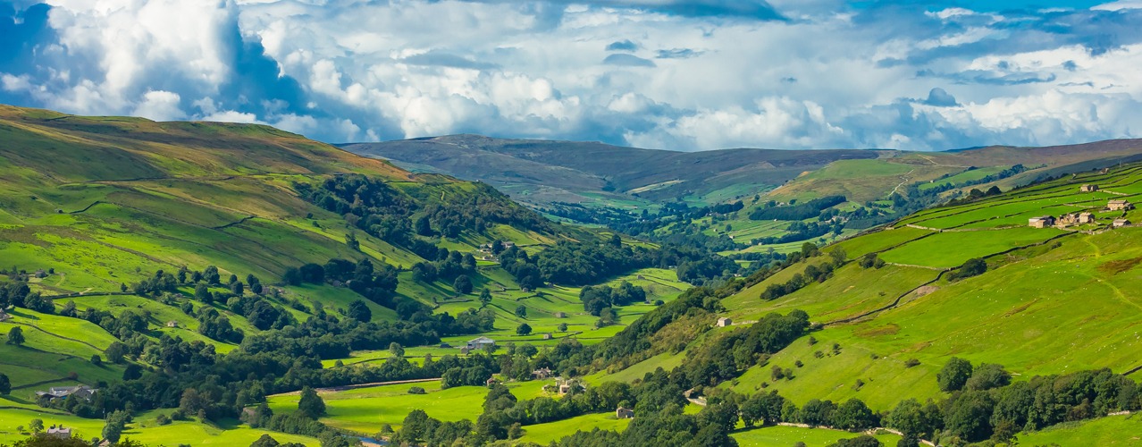
Herriot Way
5 Nights/4 Days Itinerary- 4 Nights Accommodation
- 4 Days Walking
- Total distance 52 miles

5 Nights Accommodation/4 Days Walking
- Day 1 Travel to Hawes where your first nights accommodation is booked
- Day 2 Hawes to Keld - 13 miles
- Day 3 Keld to Reeth - 13 miles
- Day 4 Reeth to Aysgarth - 13 miles
- Day 5 Aysgarth to Hawes - 13 miles
- Day 6 Depart Hawes for home
Route Description
Hawes to Keld. Distance 13 miles.
Leave Hawes and start your ascent to the summit of Great Shunner Fell (716M) for wonderful views. For much of the day you follow the Pennine Way north towards Keld. The route descends to the little village of Thwaite in Swaledale and then rounds Kisdon hill as the path climbs to Keld.
Keld to Reeth. Distance 13 miles.
Today you have the choice of following a low level route through Swaledale valley or taking the high level route through the disused lead mines. In the 18th and 19th Centuries the area was a hive of activity for lead mining, the disused workings are still visible today as you cross the moors to Reeth.
Reeth to Aysgarth. Distance 13 miles.
From Reeth follow the path to Harkerside Moor, and up onto East Bolton Moor (550M) then descend via the old lead miners track into Wensleydale. The route passes the mediaeval Bolton Castle, the 600 year old fortress that imprisoned Mary Queen of Scots in 1569 is open to visitors from April to October. The route then follows the valley to the famous Aysgarth Falls.
Aysgarth to Hawes. Distance 13 miles.
There are no high moors to cross instead the route follows the valley alongside the River Ure for a few miles. As you approach Hawes visit Hardraw Force, Englands highest single drop waterfall (above ground).
Booking
Our self guided holidays are booked on an individual basis and therefore you can start your holiday on any date of your choice between April and early October.
This Holiday Includes
- 5 nights accommodation with breakfast
- Daily luggage transfer between accommodation
- Guidebook & route map
- Accommodation directions & holiday information
- Emergency contact
- Holiday price £600 per person based on two people sharing a room. Single supplement £300.
-
Lady Anne's Way
7 Nights/6 Days Itinerary- 7 Nights Accommodation
- 6 Days Walking
- Total distance 100 miles

7 Nights Accommodation/6 Days Walking
- Day 1 Travel to Skipton where your first nights accommodation is booked
- Day 2 Skipton to Grassington - 15 miles
- Day 3 Grassington to Buckden - 13 miles
- Day 4 Buckden to Hawes - 18 miles
- Day 5 Hawes to Kirkby Stephen - 17 miles
- Day 6 Kirkby Stephen to Appleby - 17 miles
- Day 7 Appleby to Penrith - 20 miles
- Day 8 Depart Penrith for home
Route Description
Skipton (height above sea level 140m) to Grassington (200m). Distance 15 miles.
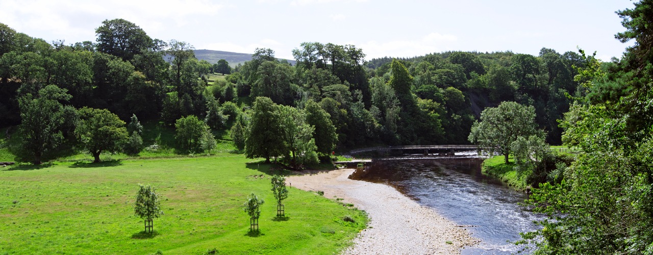
Lady Anne Clifford was born at Skipton Castle, now one of the best preserved medieval castles in England and fittingly the route begins at her birthplace. Skipton is known as the gateway to the Dales and has lots to offer, with cobbled streets and alleyways to explore, with plenty of shops and cafes to visit. Skipton castle is also worth a visit. After leaving Skipton, the first village on route is Embsay, famous for its steam railway. You continue across farmland and enter the Yorkshire Dales National Park. The next 50 miles of the Lady Anne’s Way are within the Yorkshire Dales, there is such variety to be discovered, lonely fells, idyllic riverside graze land, leafy woods, farmland and pretty villages with an interesting industrial past. The path climbs onto moorland and crosses Halton Edge (290m) before descending to the ruins of Barden Tower where Lady Anne often stayed throughout her life. The route then follows the banks of the River Wharfe to the picturesque, unspoilt village of Burnsall (150m). The route leaves the river to cross fields to Hebden and then Grassington. Grassington is a small, thriving town. It attracts many visitors with its cobbled streets and attractive buildings and once prospered from the lead- mining industry.
Grassington (200m) to Buckden (220m). Distance 13 miles.
From Grassington you walk uphill to Capplestone Gate (512m) on Conistone Moor with vast views of Wharfedale, Bastow wood and Lea green. After the uphill trek it’s a gradual walk downhill to delightful Kettlewell (210m) which has a few shops and pubs. The route continues through fields to Starbotton, before following the River Wharfe to Buckden.
Buckden (220m) to Hawes (240m). Distance 18 miles.
From Buckden the path climbs to the top of Stake Moss (558m) to a route once used by the Romans, and Lady Anne herself to visit her castles in the Eden Valley. The path is easy to follow and descends gradually to join a bridleway and a clear track to Cubeck and from there to Worton (200m). From Worton it’s on to Nappa Hall, a well preserved medieval building, where Lady Anne stayed one night. Other famous visitors include James 1, Sir Walter Raleigh and Mary Queen of Scots. Then it’s onward to Askrigg with shops, cafés restaurants. The painter Turner stayed at the King’s Arms and in the market place there is a commemorative seat for the travels he undertook in the 19th century, it is known as the Turner trail seat. Also, Crinkley House in Askrigg (230m) was frequently used in the television series ‘All Creatures great & small’. From Askrigg the walk takes you along Wensleydale valley. It is worth visiting Mill Gill falls, a few yards off route the waterfalls are a sight to see. Then it’s onward across fields to Hawes, a busy market town in Upper Wensleydale with lots of visitor attractions, cafes and shops.
Hawes (240m) to Kirkby Stephen (180m). Distance 17 miles.
From Hawes there is a walk through fields to Appersett viaduct. You follow the River Ure to the ‘Highway’, where the path climbs to take this ancient high route over the fells from Wensleydale to Mallerstang valley. The Highway (highest point 500m) was used by the Romans. In the 18th century it was a packhorse route for goods from Wensleydale to Kendal and was also used by Lady Anne on her way to Pendragon Castle. There are superb views all around as a reward. While on the Highway there are deserted buildings to see, one being High Hall. The next point is to Hell Gill Bridge; look over the right side at its steep sided ravine. It is believed a highwayman on horseback jumped this gully to escape capture. The bridge also denotes the border between Cumbria and Yorkshire. The Highway descends, at the valley bottom, there is a sculpture called ‘Water cut’ by Mary Bourne and is known as the Eden Benchmarks. It is one of ten commissioned by East Cumbria Countryside Project. The route follows the river to Outhgill (250m) and Pendragon Castle. Locally it is believed the castle was built by Uther Pendragon, father of Arthur of the round table. Lady Anne restored the castle in 1660 and was a useful stopping point for her on the way to her castles in the Eden Valley. From the castle the route continues to Nateby village from where it’s a short walk to the market town of Kirkby Stephen.
Kirkby Stephen (180m) to Appleby-in-Westmorland (150m). Distance 17 miles.
This section offers wonderful scenery and is steep with historical interest, with the ruins of Brough Castle, Ormside ‘Cross’ and church, ending in Appleby with its magnificent castle and churches. The path follows the river downstream, to your right there are views of Nine Standards Rigg in the skyline, then across fields to the outskirts of Winton village. Shortly after Winton you leave the valley of Mallerstang to begin your journey through the lovely Eden Valley. Passing the hamlet of Kaber, walk along Belah River with views to the red cliffs of Belah Scar. The next village is Brough Sowerby then to Church Brough (180m), where you can wander off route to visit the castle remains. Lady Anne’s Way takes you through the centre of Church Brough then through some fields to follow a good path, contouring Langrigg Hill to Flitholme. There is the option to visit Warcop village or continue along Lady Annes Way to Warcop Old Bridge. The track takes you along bridleways, hedge lined paths, riverbanks, and farmland to Little Ormside and Great Ormside. The church of St James in Great Ormside is rich in history and worth visiting if time allows. There is easy walking alongside the River Eden to Appleby. The castle restored by Lady Anne is now privately owned and is therefore not open to the public. However there is still plenty to see in Appleby and wherever you go there are references to Lady Anne. The church of St Lawrence holds the elaborate tomb of Lady Anne and her mother Margaret Countess of Cumberland. Appleby is extremely busy in early June with travellers and horse traders, it holds the biggest horse fair of its kind in the world.
Appleby-in-Westmorland (150m) to Penrith (140m). Distance 20 miles.
This section is a low level route with splendid views, delightful villages and ancient ruins of Brougham Hall and Brougham Castle, just before reaching Penrith and the end of the trail. On leaving Appleby you continue through fields to the delightful village of Long Marton (130m). The church here was built in the 12th century on the site of an earlier wooden structure. Leaving the village it’s onward to Kirkby Thore, where there is the hall of medieval origin and a site of a Roman Fort. From here the path follows the River Eden to Ousenstand Bridge (100m) then continues to Crossrigg Hall, built in 1864 to a Jacobean design and retains some of its original features. It’s then Cliburn with its church standing in a prominent position above the River Leith. After Cliburn there is a section of road walking with a good grass verge if you prefer, with Whinfell Forest to your right. Then it is onwards to Pembroke House and then Brougham Hall. The ruins of Brougham hall are undergoing restoration. In the stables and carriage houses there is a craft fair and a café. From Brougham Hall your next landmark is Brougham castle. The castle is an extensive ruin and was built by Robert de Vipont one of Lady Anne’s ancestors. Lady Anne spent a lot of time here, her father was born here and both she and her mother died here. From the castle it’s a short walk to Penrith. In the centre of town is the market square, with a monument and clock tower marking the end of Lady Anne’s Way.
Booking
Our self guided holidays are booked on an individual basis and therefore you can start your holiday on any date of your choice between April and early October.
This Holiday Includes
- 7 nights accommodation with breakfast
- Daily luggage transfer between accommodation
- Guidebook & route map
- Accommodation directions & holiday information
- Emergency contact
- Holiday price £825 per person based on two people sharing a room. Single supplement £385.
-
Offa's Dyke Path
14 Nights/13 Days Itinerary- 14 Nights Accommodation
- 13 Days Walking
- Total distance 177 miles

14 Nights Accommodation/13 Days Walking
- Day 1 Travel to Chepstow where your first nights accommodation is booked
- Day 2 Sedbury Cliffs to Monmounth - 18 miles
- Day 3 Monmounth to Llangattock Lingoed - 14 miles
- Day 4 Llangattock Lingoed to Longtown - 8 miles
- Day 5 Longtown to Hay-on-Wye - 14 miles
- Day 6 Hay-on-Wye to Kington - 14 miles
- Day 7 Kington to Knighton - 14 miles
- Day 8 Knighton to Brompton - 15 miles
- Day 9 Brompton to Buttington Bridge - 13 miles
- Day 10 Buttington Bridge to Trefonen - 16 miles
- Day 11 Trefonen to Llangollen - 16 miles
- Day 12 Llangollen to Clwyd Gate - 14 miles
- Day 13 Clwyd Gate to Bodfari - 11 miles
- Day 14 Bodfari to Prestatyn - 12 miles
- Day 15 Depart Prestatyn for home
Route Description
Sedbury Cliffs/Chepstow (height above sea level 10m) to Monmouth (20m). Distance 18 miles.
Offa’s Dyke Path (ODP) starts in England at Sedbury Cliffs (near to Chepstow) overlooking the Severn estuary. The Dyke itself is first met at the very start of the ODP, close to Sedbury Cliff. The ODP passes to the east of Chepstow with views of Chepstow Castle. From here the ODP continues its journey north on the eastern side of the River Wye high on the tree lined escarpment with a number of classic viewpoints, one of the most iconic being the view of Tintern Abbey from Devil’s Pulpit. The Wye Valley is one of the finest lowland landscapes in Britain and was designated as an Area of Outstanding Natural Beauty in 1971. Along this section the ODP offers several route options which meet at Bigsweir. The ODP continues through woodland and at Redbrook it makes the first of many border crossings between England and Wales, and continues to Monmouth, a Welsh border town situated at the confluence of the Rivers Wye, Monnow and Trothy and perhaps best known as the birthplace of Henry V.
Monmouth (20m) to Llangattock Lingoed (150m). Distance 14 miles.
From the town centre the ODP crosses over the 13th century Monnow Bridge, the only remaining medieval fortified bridge in Great Britain. Leaving behind the River Wye the ODP crosses quiet rolling farmland, mainly sheep country. It passes through woodland on route to Hendre, it then crosses farmland to the church at Llanvihangel-Ystern-Llewern, and continues to the village of Llantilio Crossenny. Continuing across the rolling farmland the ODP passes alongside the medieval White Castle on route to the village of Llangattock Lingoed and the medieval St. Cadoc's Church.
Llangattock Lingoed (150m) to Longtown (140m). Distance 8 miles.
Approaching Pandy there are great views of the Black Mountains including Hatterrall Ridge over which the next part of the Trail passes.From Pandy a steady climb brings you to the first upland section of the ODP. It takes the route along Hatterrall Ridge in the Black Mountains, which are the eastern edge of the Brecon Beacons National Park. Once the first summit has been reached the ODP follows a well-defined ridge walk with stunning views to either side. Much of the ODP follows the ridge path at over 600metres. A few miles into the ridge crossing descend from 500metres and overnight at Longtown (140m) with its 12th century Norman Castle.
Longtown (140m) to Hay-on-Wye (90m). Distance 14 miles.
The following morning transport will take you a short way back uphill from where you follow a footpath for a 300metre climb back onto the ridge. Continue to follow the ridge crossing Hay Bluff (677m) which is the northern high point of the ridge from where the ODP descends into Hay-on-Wye (90m), famed for its numerous bookshops, the town also has the ruins of two Norman castles.
Hay-on-Wye (90m) to Kington (170m). Distance 14 miles.
From Hay-on-Wye the ODP follows level paths alongside the River Wye, last seen in Monmouth. After a couple of miles the ODP leaves the river to begin a rolling route through farmland. The ODP climbs and contours around Little Mountain (approx. 320m) then descends into the village of Newchurch (240m) - the church here is always open and welcomes walkers and you can help yourself to a cup of tea for a small donation. The ODP climbs again into rolling hills before descending into in Gladestry (225m). The final stage across hill country before Kington is to follow the ODP over Hergest Ridge (426m) with wonderful views all-round. Crossing the ridge you pass an old racecourse which is exactly a mile around. This area was also the inspiration for Arthur Conan Doyle’s Hound of the Baskervilles and Mike Oldfield’s second album Hergest Ridge. Descending from the ridge you join a road which leads to the historic market town of Kington.
Kington (170m) to Knighton (175m). Distance 14 miles.
On this stage the ODP follows long stretches of well-preserved Dyke before it enters Knighton (Tref-y-Clawdd, meaning the town on the dyke in Welsh). On leaving Kington the ODP rise over Brandor Hill and its golf course. A high point of approx. 390m makes Kington Golf Course the highest in England. Soon after the ODP meets up with Offa’s Dyke on Rushock Hill (375m), from this point to Chirk Castle the ODP and Offa’s Dyke keep each other company for most of the journey. The ODP now continues its journey across the rolling countryside. The highest peak on this section is Hawthorn Hill (407m) a few miles before Knighton. There are stunning views from the hill and one of Owain Glyndwr’s (the last native Welshman to hold the title Prince of Wales) famous battle sites can also be seen from here where he fought the English at the Battle of Pilleth, with the square clump of trees that mark the burial site of the soldiers. The final decent brings you down into the historic market town of Knighton, almost the half-way point along Offa’s Dyke Path and the home of the Offa’s Dyke Centre.
Knighton (175m) to Brompton (140m). Distance 15 miles.
This next section of the ODP is generally regarded to be the toughest. This is the ‘switchback’ section and the ODP rises and falls through the Shropshire Hills an Area of Outstanding Natural Beauty. However the views make the effort worthwhile. Shortly after leaving Knighton the ODP climbs into the Shropshire Hills, the highest point is 430metres as the ODP crosses Llanfair Hill alongside some of the best preserved sections of Offa’s Dyke. Just above Newcastle on Clun you are at the true midpoint of the ODP, with its midway marker, a good photo opportunity for all walkers. The ODP descends into the Clun Valley. The ODP climbs into the hills again and at Hergan there is what seems to be a natural break in the Dyke, where the Shropshire Way joins the Dyke for a short distance. There are very few villages on this section but a number of hidden gems await the walker, one of these is Churchtown - at the foot of a narrow valley you find the church, but no sign of a town. Within a couple of miles the ODP crosses the Kerry Ridgeway trail from this point on it is level or downhill. Shortly before Brompton the ODP goes through the hamlet of Cwm and passes Mellington Hall, areas with a scattering of accommodation.
Brompton (140m) to Buttington Bridge (70m). Distance 13 miles.
For the next couple of miles the ODP follows the Dyke across fairly level terrain as it passes to the right of Montgomery. The ODP then rises to pass Nantcribba and over the next few miles continues to rise to Beacon Ring (408m), the earthworks of the ancient hill fort on the summit of Long Mountain, with views down to Welshpool. The ODP then descends to Buttington Bridge where you meet the River Severn, from where it is a short walk into the busy market town of Welshpool.
Buttington Bridge (70m) to Trefonen (175m). Distance 16 miles.
This walk to Llanymynech is almost flat throughout and is the easiest section of the ODP. Leaving Buttington Bridge the ODP follows the Montgomery Canal and then River Severn for several miles before crossing fields to the village of Four Crosses. The ODP then follows the Montgomery Canal to the town of Llanymynech (75m) where the Wales – England border is the main street! After the flattest section the ODP, it returns to rising and falling via Llanymynech Hill (226m) and Moelydd (285m). The summit of Moelydd is one of the surprises of the day - the 360 degree views are stunning and a topascope helps you identify the many hills you see. Trefonen is just a short walk away.
Trefonen (175m) to Llangollen (100m). Distance 16 miles.
Continuing its way north across the rolling countryside the ODP passes a few miles from the town of Oswestry. Oswestry, or "Oswald's Tree", is generally thought to be derived from Oswald's death there and the legends surrounding it. Oswald lived in the 7th century and was the powerful King of Northumbria. He spread Christian religion in Northumbria and soon after his death came to be regarded as a saint. The 97 mile route from Holy Island to Heavenfield, in Northumbria, is named after St Oswald. The ODP continues across the rolling countryside then descends to the River Ceiriog at Castle Mill, close to Chirk. From the river the summer season path leads past Chirk Castle, set in 480 acres of parklands. With over 700 years of history, and as the last castle from this period still lived in today, you can visit if time allows. From the castle the ODP crosses a few miles of farmland towards Trevor where you have the option to cross Pontcysyllte Aqueduct, now listed as a World Heritage Site it is the largest aqueduct in Britain. It is now only a few miles to Llangollen, a town situated on the River Dee, and there are two possible routes to take.
Llangollen (100m) to Clwyd Gate (286m). Distance 14 miles.
The ODP is above Llangollen where it passes medieval castle Dinas Bran (320m), overlooking the town, at Trevor Rocks. A climb up from the town brings you to the route. This area is now part of the Clwydian Range, the series of hills and mountains before the ODP arrives at Prestatyn. For the next few miles the ODP contours round below the crags of Eglwyseg Mountain to the well named ‘World’s End’ (300m). The ODP then passes over the moorland (475m) before descending through Llandegla Forest, to Llandegla (250m). For a short distance the route stays close to the River Alyn then climbs bank into Clwydian Range and for much of the time you are following the heather clad ridge that is so prominent in this area to Clwyd Gate.
Clwyd Gate (286m) to Bodfari (40m). Distance 11 miles.
From Clwyd Gate the ODP continues along the ridge over the hills and mountains of the Clwydian Range. It passes over or beside a string of ancient hill forts on its journey including Foel Fenlli, Moel Arthur and Penycloddiau. The key landmark on this section of the ODP is Jubilee Tower on the top of Moel Famau (554m). The tower was built to celebrate the 50th year of the reign of George 3rd in 1810. The summit of Moel Famau is also the high point on this section of the ODP. This section affords magnificent views westwards across the Vale of Clwyd to Snowdonia and eastwards to the English border and beyond. The ODP descends from the hills into the valley and the village of Bodfari.
Bodfari (40m) to Prestatyn (5m). Distance 12 miles.
For the next few miles the ODP continues over the last remaining, but lower, hills of the Clwydian Range to Rhuallt village. The ODP continues over the rolling countryside and views of the sea open up as you approach journeys end. Fabulous views of Snowdonia and the North Wales coast are seen from Prestatyn Hillside before you descend into the town and onwards to the end of the ODP at Prestatyn beach. Traditionally at this point boots and socks are removed and a walk into the Irish Sea marks the end of your journey and gives some relief to those tired feet.
Booking
Our self guided holidays are booked on an individual basis and therefore you can start your holiday on any date of your choice between April and early October.
This Holiday Includes
14 nights accommodation with breakfast
Daily luggage transfer between accommodation
Guidebook & route maps
Accommodation directions & holiday information
Emergency contact
Holiday price £1450 per person based on two people sharing a room. Single supplement £770.
-
Offa's Dyke Path North
8 Nights/7 Days Itinerary- 8 Nights Accommodation
- 7 Days Walking
- Total distance 97 miles

8 Nights Accommodation/7 Days Walking
- Day 1 Travel to Knighton where your first nights accommodation is booked
- Day 2 Knighton to Brompton - 15 miles
- Day 3 Brompton to Buttington Bridge - 13 miles
- Day 4 Buttington Bridge to Trefonen - 16 miles
- Day 5 Trefonen to Llangollen - 16 miles
- Day 6 Llangollen to Clwyd Gate - 14 miles
- Day 7 Clwyd Gate to Bodfari - 11 miles
- Day 8 Bodfari to Prestatyn - 12 miles
- Day 9 Depart Prestatyn for home
Route Description
Knighton (175m) to Brompton (140m).
The section from Knighton to Brompton is generally regarded to be the toughest. This is the ‘switchback’ section and the ODP rises and falls through the Shropshire Hills an Area of Outstanding Natural Beauty. However the views make the effort worthwhile. Shortly after leaving Knighton the ODP climbs into the Shropshire Hills, the highest point is 430metres as the ODP crosses Llanfair Hill alongside some of the best preserved sections of Offa’s Dyke. Just above Newcastle on Clun you are at the true midpoint of the the full route ODP, with its midway marker. The ODP descends into the Clun Valley. The ODP climbs into the hills again and at Hergan there is what seems to be a natural break in the Dyke, where the Shropshire Way joins the Dyke for a short distance. There are very few villages on this section but a number of hidden gems await the walker, one of these is Churchtown - at the foot of a narrow valley you find the church, but no sign of a town. Within a couple of miles the ODP crosses the Kerry Ridgeway trail from this point on it is level or downhill. Shortly before Brompton the ODP goes through the hamlet of Cwm and passes Mellington Hall, areas with a scattering of accommodation.
Brompton (140m) to Buttington Bridge (70m).
For the next couple of miles the ODP follows the Dyke across fairly level terrain as it passes to the right of Montgomery. The ODP then rises to pass Nantcribba and over the next few miles continues to rise to Beacon Ring (408m), the earthworks of the ancient hill fort on the summit of Long Mountain, with views down to Welshpool. The ODP then descends to Buttington Bridge where you meet the River Severn, from where it is a short walk into the busy market town of Welshpool.
Buttington Bridge (70m) to Trefonen (175m).
This walk to Llanymynech is almost flat throughout and is the easiest section of the ODP. Leaving Buttington Bridge the ODP follows the Montgomery Canal and then River Severn for several miles before crossing fields to the village of Four Crosses. The ODP then follows the Montgomery Canal to the town of Llanymynech (75m) where the Wales – England border is the main street! After the flattest section the ODP, it returns to rising and falling via Llanymynech Hill (226m) and Moelydd (285m). The summit of Moelydd is one of the surprises of the day - the 360 degree views are stunning and a topascope helps you identify the many hills you see. Trefonen is just a short walk away.
Trefonen (175m) to Llangollen (100m).
Continuing its way north across the rolling countryside the ODP passes a few miles from the town of Oswestry. Oswestry, or "Oswald's Tree", is generally thought to be derived from Oswald's death there and the legends surrounding it. Oswald lived in the 7th century and was the powerful King of Northumbria. He spread Christian religion in Northumbria and soon after his death came to be regarded as a saint. The 97 mile route from Holy Island to Heavenfield, in Northumbria, is named after St Oswald. The ODP continues across the rolling countryside then descends to the River Ceiriog at Castle Mill, close to Chirk. From the river the summer season path leads past Chirk Castle, set in 480 acres of parklands. With over 700 years of history, and as the last castle from this period still lived in today, you can visit if time allows. From the castle the ODP crosses a few miles of farmland towards Trevor where you have the option to cross Pontcysyllte Aqueduct, now listed as a World Heritage Site it is the largest aqueduct in Britain. It is now only a few miles to Llangollen, a town situated on the River Dee, and there are two possible routes to take.
Llangollen (100m) to Clwyd Gate (286m).
The ODP is above Llangollen where it passes medieval castle Dinas Bran (320m), overlooking the town, at Trevor Rocks. A climb up from the town brings you to the route. This area is now part of the Clwydian Range, the series of hills and mountains before the ODP arrives at Prestatyn. For the next few miles the ODP contours round below the crags of Eglwyseg Mountain to the well named ‘World’s End’ (300m). The ODP then passes over the moorland (475m) before descending through Llandegla Forest, to Llandegla (250m). For a short distance the route stays close to the River Alyn then climbs bank into Clwydian Range and for much of the time you are following the heather clad ridge that is so prominent in this area to Clwyd Gate.
Clwyd Gate (286m) to Bodfari (40m).
From Clwyd Gate the ODP continues along the ridge over the hills and mountains of the Clwydian Range. It passes over or beside a string of ancient hill forts on its journey including Foel Fenlli, Moel Arthur and Penycloddiau. The key landmark on this section of the ODP is Jubilee Tower on the top of Moel Famau (554m). The tower was built to celebrate the 50th year of the reign of George 3rd in 1810. The summit of Moel Famau is also the high point on this section of the ODP. This section affords magnificent views westwards across the Vale of Clwyd to Snowdonia and eastwards to the English border and beyond. The ODP descends from the hills into the valley and the village of Bodfari.
Bodfari (40m) to Prestatyn (5m).
For the next few miles the ODP continues over the last remaining, but lower, hills of the Clwydian Range to Rhuallt village. The ODP continues over the rolling countryside and views of the sea open up as you approach journeys end. Fabulous views of Snowdonia and the North Wales coast are seen from Prestatyn Hillside before you descend into the town and onwards to the end of the ODP at Prestatyn beach. Traditionally at this point boots and socks are removed and a walk into the Irish Sea marks the end of your journey and gives some relief to those tired feet.
Booking
Our self guided holidays are booked on an individual basis and therefore you can start your holiday on any date of your choice between April and early October.
This Holiday Includes
8 nights accommodation with breakfast
Daily luggage transfer between accommodation
Guidebook & route map
Accommodation directions & holiday information
Emergency contact
Holiday price £850 per person based on two people sharing a room. Single supplement £440.
-
Offa's Dyke Path South
7 Nights/6 Days Itinerary- 7 Nights Accommodation
- 6 Days Walking
- Total distance 97 miles

7 Nights Accommodation/6 Days Walking
- Day 1 Travel to Chepstow where your first nights accommodation is booked
- Day 2 Sedbury Cliffs to Monmouth - 18 miles
- Day 3 Monmouth to Llangtock Lingoed - 14 miles
- Day 4 Llangtock Lingoed to Longtown - 8 miles
- Day 5 Longtown to Hay-on-Wye - 14 miles
- Day 6 Hay-on-Wye to Kington - 14 miles
- Day 7 Kington to Knighton - 14 miles
- Day 8 Depart Knighton for home
Route Description
Sedbury Cliffs/Chepstow (height above sea level 10m) to Monmouth (20m).
Offa’s Dyke Path (ODP) starts in England at Sedbury Cliffs (near to Chepstow) overlooking the Severn estuary. The Dyke itself is first met at the very start of the ODP, close to Sedbury Cliff. The ODP passes to the east of Chepstow with views of Chepstow Castle. From here the ODP continues its journey north on the eastern side of the River Wye high on the tree lined escarpment with a number of classic viewpoints, one of the most iconic being the view of Tintern Abbey from Devil’s Pulpit. The Wye Valley is one of the finest lowland landscapes in Britain and was designated as an Area of Outstanding Natural Beauty in 1971. Along this section the ODP offers several route options which meet at Bigsweir. The ODP continues through woodland and at Redbrook it makes the first of many border crossings between England and Wales, and continues to Monmouth, a Welsh border town situated at the confluence of the Rivers Wye, Monnow and Trothy and perhaps best known as the birthplace of Henry V.
Monmouth (20m) to Llangattock Lingoed (150m).
From the town centre the ODP crosses over the 13th century Monnow Bridge, the only remaining medieval fortified bridge in Great Britain. Leaving behind the River Wye the ODP crosses quiet rolling farmland, mainly sheep country. It passes through woodland on route to Hendre, it then crosses farmland to the church at Llanvihangel-Ystern-Llewern, and continues to the village of Llantilio Crossenny. Continuing across the rolling farmland the ODP passes alongside the medieval White Castle on route to the village of Llangattock Lingoed and the medieval St. Cadoc's Church.
Llangattock Lingoed (150m) to Longtown (140m).
Approaching Pandy there are great views of the Black Mountains including Hatterrall Ridge over which the next part of the Trail passes.From Pandy a steady climb brings you to the first upland section of the ODP. It takes the route along Hatterrall Ridge in the Black Mountains, which are the eastern edge of the Brecon Beacons National Park. Once the first summit has been reached the ODP follows a well-defined ridge walk with stunning views to either side. Much of the ODP follows the ridge path at over 600metres. A few miles into the ridge crossing descend from 500metres and overnight at Longtown (140m) with its 12th century Norman Castle.
Longtown (140m) to Hay-on-Wye (90m).
The following morning transport will take you a short way back uphill from where you follow a footpath for a 300metre climb back onto the ridge. Continue to follow the ridge crossing Hay Bluff (677m) which is the northern high point of the ridge from where the ODP descends into Hay-on-Wye (90m), famed for its numerous bookshops, the town also has the ruins of two Norman castles.
Hay-on-Wye (90m) to Kington (170m).
From Hay-on-Wye the ODP follows level paths alongside the River Wye, last seen in Monmouth. After a couple of miles the ODP leaves the river to begin a rolling route through farmland. The ODP climbs and contours around Little Mountain (approx. 320m) then descends into the village of Newchurch (240m) - the church here is always open and welcomes walkers and you can help yourself to a cup of tea for a small donation. The ODP climbs again into rolling hills before descending into in Gladestry (225m). The final stage across hill country before Kington is to follow the ODP over Hergest Ridge (426m) with wonderful views all-round. Crossing the ridge you pass an old racecourse which is exactly a mile around. This area was also the inspiration for Arthur Conan Doyle’s Hound of the Baskervilles and Mike Oldfield’s second album Hergest Ridge. Descending from the ridge you join a road which leads to the historic market town of Kington.
Kington (170m) to Knighton (175m).
On this stage the ODP follows long stretches of well-preserved Dyke before it enters Knighton (Tref-y-Clawdd, meaning the town on the dyke in Welsh). On leaving Kington the ODP rise over Brandor Hill and its golf course. A high point of approx. 390m makes Kington Golf Course the highest in England. Soon after the ODP meets up with Offa’s Dyke on Rushock Hill (375m), from this point to Chirk Castle the ODP and Offa’s Dyke keep each other company for most of the journey. The ODP now continues its journey across the rolling countryside. The highest peak on this section is Hawthorn Hill (407m) a few miles before Knighton. There are stunning views from the hill and one of Owain Glyndwr’s (the last native Welshman to hold the title Prince of Wales) famous battle sites can also be seen from here where he fought the English at the Battle of Pilleth, with the square clump of trees that mark the burial site of the soldiers. The final decent brings you down into the historic market town of Knighton, home of the Offa’s Dyke Centre.
Booking
Our self guided holidays are booked on an individual basis and therefore you can start your holiday on any date of your choice between April and early October.
This Holiday Includes
7 nights accommodation with breakfast
Daily luggage transfer between accommodation
Guidebook & route map
Accommodation directions & holiday information
Emergency contact
Holiday price £750 per person based on two people sharing a room. Single supplement £385.
-
St Cuthberts Way
8 Nights/7 Days Itinerary- 8 Nights Accommodation
- 7 Days Walking
- Total distance 62 miles

8 Nights Accommodation/7 Days Walking
- Day 1 Travel to Melrose where your first nights accommodation is booked
- Day 2 Melrose to St Boswells - 8 miles
- Day 3 St Boswells to Harestanes - 7 miles
- Day 4 Harestanes to Morebattle - 10 miles
- Day 5 Morebattle to Kirk Yetholm - 6 miles
- Day 6 Kirk Yetholm to Wooler - 13 miles
- Day 7 Wooler to Fenwick - 12 miles
- Day 8 Fenwick to Holy Island - 6 miles
- Day 9 Depart Holy Island for home
Route Description
Melrose (height above sea level 85m) to St. Boswells (90m). Distance 8 miles.
St. Cuthbert's Way starts at the gates of the magnificent ruin of 12th century Melrose Abbey in the Borders town of Melrose. From Melrose, a steep climb takes you over the saddle (310m) between the Eildon Hills. There are wonderful views in every direction. The route descends to the village of Bowden and leads you through farmland and woodland to Newtown St Boswells. A short walk along the banks of the River Tweed takes you into St. Boswells (90m).
St. Boswells (90m) to Harestanes (60m). Distance 7 miles.
You continue along the banks of the River Tweed for a short distance then walk across farmland to follow Dere Street, you will be following in the footsteps of the Romans who built the original road, now a tree lined grassy track across the undulating landscape to Harestanes Countryside Visitor Centre.
Harestanes (60m) to Morebattle (95m). Distance 10 miles.
You re-join the route at Harestanes and pass Monteviot House then cross the River Teviot. After a short walk along the river you follow paths across farmland and open moor to the village of Cessford and the ruins of Cessford Castle, once the stronghold of the Kers, notorious Border Reivers. The route now follows country lanes to the village of Morebattle (95m).
Morebattle (95m) to Kirk Yetholm (100m). Distance 6 miles.
After leaving Morebattle St. Cuthbert’s Way takes a route over the hills to Kirk Yetholm; this is regarded as the hardest section of the walk. You follow paths as you climb Grubbit Law and cross Wideopen Hill (368M), the highest point on St. Cuthbert’s Way, then Crookedshaws Hill before descending to Kirk Yetholm. Kirk Yetholm is the northern most point on the Pennine Way and you may meet walkers finishing or are about to start the 268 mile route across the rugged backbone of England.
Kirk Yetholm (100m) to Wooler (50m). Distance 13 miles.
The route leaves Kirk Yetholm along a short section of the Pennine Way. You climb and cross the hills (340m) to Hethpool (120m), passing one of many hillforts along St. Cuthbert’s Way and crossing the border from Scotland into England. At the border you will cross into Northumberland National Park, one of Britain’s best kept secrets. Then it’s on through woodland and a good track along the Cheviot foothills. The route rises to 340 metres and you cross the hills to the small market town of Wooler, where you will find shops, cafes and pubs.
Wooler (50m) to Fenwick (40m). Distance 12 miles.
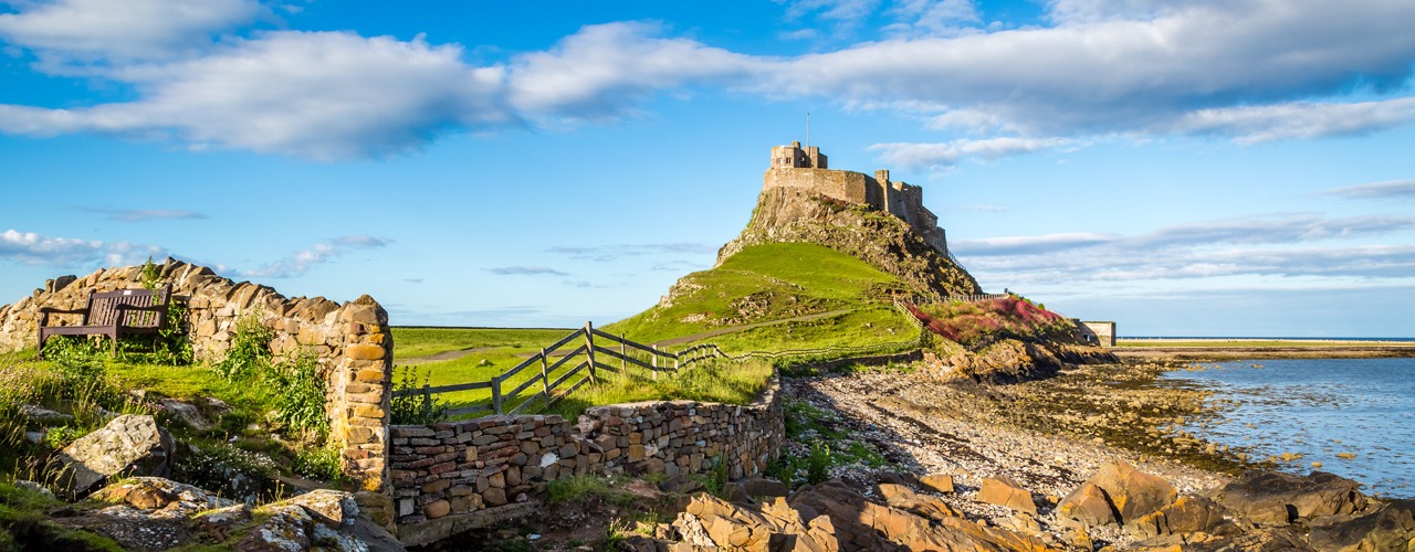
Between Wooler to Fenwick the terrain is easier as St Cuthbert’s Way crosses rolling hills. You leave Wooler and follow paths over Weetwood Moor (150m), quiet lanes then lead to Horton. Paths and tracks lead across farmland to woodland owned and managed by the National Trust. Here you will find St. Cuthbert’s Cave, a sandstone cave where monks took St. Cuthbert’s body in 875AD as they fled from repeated Viking raids on Lindisfarne. After a short uphill walk you get your first view of Holy Island and Lindisfarne Castle. The route leads you into woodland and onto the village of Fenwick. There is a scattering of nearby accommodation.
Fenwick (40m) to Holy Island (15m). Distance 6 miles.
From Fenwick it is a few miles across farmland to the Causeway, which can be crossed at low tide to Holy Island. Plan your day so you arrive to walk over to the island when the tide is out and it is safe to cross. Having reached the Causeway you can either cross via the Causeway Road or follow the posts of the historic Pilgrims Path across the sands. Once on the island it is a short walk to the village and the end of St. Cuthbert’s Way. Here you can see the ruins of the Priory and view Lindisfarne Castle.
Booking
Our self guided holidays are booked on an individual basis and therefore you can start your holiday on any date of your choice between April and early October.
This Holiday Includes
8 nights accommodation with breakfast
Daily luggage transfer between accommodation
Guidebook & route map
Accommodation directions & holiday information
Emergency contact
Holiday price £950 per person based on two people sharing a room. Single supplement £440.
-
St Cuthberts Way
7 Nights/6 Days Itinerary- 7 Nights Accommodation
- 6 Days Walking
- Total distance 62 miles
7 Nights Accommodation/6 Days Walking
- Day 1 Travel to Melrose where your first nights accommodation is booked
- Day 2 Melrose to Harestanes - 15 miles
- Day 3 Harestanes to Morebattle - 10 miles
- Day 4 Morebattle to Kirk Yetholm - 6 miles
- Day 5 Kirk Yetholm to Wooler - 13 miles
- Day 6 Wooler to Fenwick - 12 miles
- Day 7 Fenwick to Holy Island - 6 miles
- Day 8 Depart Holy Island for home
Route Description
Melrose (height above sea level 85m) to Harestanes (60m). Distance 15 miles.
St. Cuthbert's Way starts at the gates of the magnificent ruin of 12th century Melrose Abbey in the Borders town of Melrose. From Melrose, a steep climb takes you over the saddle (310m) between the Eildon Hills. There are wonderful views in every direction. The route descends to the village of Bowden and leads you through farmland and woodland to Newtown St Boswells. A short walk along the banks of the River Tweed takes you into St. Boswells (90m). You continue along the banks of the River Tweed for a short distance then walk across farmland to follow Dere Street, you will be following in the footsteps of the Romans who built the original road, now a tree lined grassy track across the undulating landscape to Harestanes Countryside Visitor Centre.
Harestanes (60m) to Morebattle (95m). Distance 10 miles.
You re-join the route at Harestanes and pass Monteviot House then cross the River Teviot. After a short walk along the river you follow paths across farmland and open moor to the village of Cessford and the ruins of Cessford Castle, once the stronghold of the Kers, notorious Border Reivers. The route now follows country lanes to the village of Morebattle (95m).
Morebattle (95m) to Kirk Yetholm (100m). Distance 6 miles.
After leaving Morebattle St. Cuthbert’s Way takes a route over the hills to Kirk Yetholm; this is regarded as the hardest section of the walk. You follow paths as you climb Grubbit Law and cross Wideopen Hill (368M), the highest point on St. Cuthbert’s Way, then Crookedshaws Hill before descending to Kirk Yetholm. Kirk Yetholm is the northern most point on the Pennine Way and you may meet walkers finishing or are about to start the 268 mile route across the rugged backbone of England.
Kirk Yetholm (100m) to Wooler (50m). Distance 13 miles.
The route leaves Kirk Yetholm along a short section of the Pennine Way. You climb and cross the hills (340m) to Hethpool (120m), passing one of many hillforts along St. Cuthbert’s Way and crossing the border from Scotland into England. At the border you will cross into Northumberland National Park, one of Britain’s best kept secrets. Then it’s on through woodland and a good track along the Cheviot foothills. The route rises to 340 metres and you cross the hills to the small market town of Wooler, where you will find shops, cafes and pubs.
Wooler (50m) to Fenwick (40m). Distance 12 miles.
Between Wooler to Fenwick the terrain is easier as St Cuthbert’s Way crosses rolling hills. You leave Wooler and follow paths over Weetwood Moor (150m), quiet lanes then lead to Horton. Paths and tracks lead across farmland to woodland owned and managed by the National Trust. Here you will find St. Cuthbert’s Cave, a sandstone cave where monks took St. Cuthbert’s body in 875AD as they fled from repeated Viking raids on Lindisfarne. After a short uphill walk you get your first view of Holy Island and Lindisfarne Castle. The route leads you into woodland and onto the village of Fenwick. There is a scattering of nearby accommodation.
Fenwick (40m) to Holy Island (15m). Distance 6 miles.
From Fenwick it is a few miles across farmland to the Causeway, which can be crossed at low tide to Holy Island. Plan your day so you arrive to walk over to the island when the tide is out and it is safe to cross. Having reached the Causeway you can either cross via the Causeway Road or follow the posts of the historic Pilgrims Path across the sands. Once on the island it is a short walk to the village and the end of St. Cuthbert’s Way. Here you can see the ruins of the Priory and view Lindisfarne Castle.
Booking
Our self guided holidays are booked on an individual basis and therefore you can start your holiday on any date of your choice between April and early October.
This Holiday Includes
7 nights accommodation with breakfast
Daily luggage transfer between accommodation
Guidebook & route map
Accommodation directions & holiday information
Emergency contact
Holiday price £850 per person based on two people sharing a room. Single supplement £385.