- Guided Walking Holidays
-
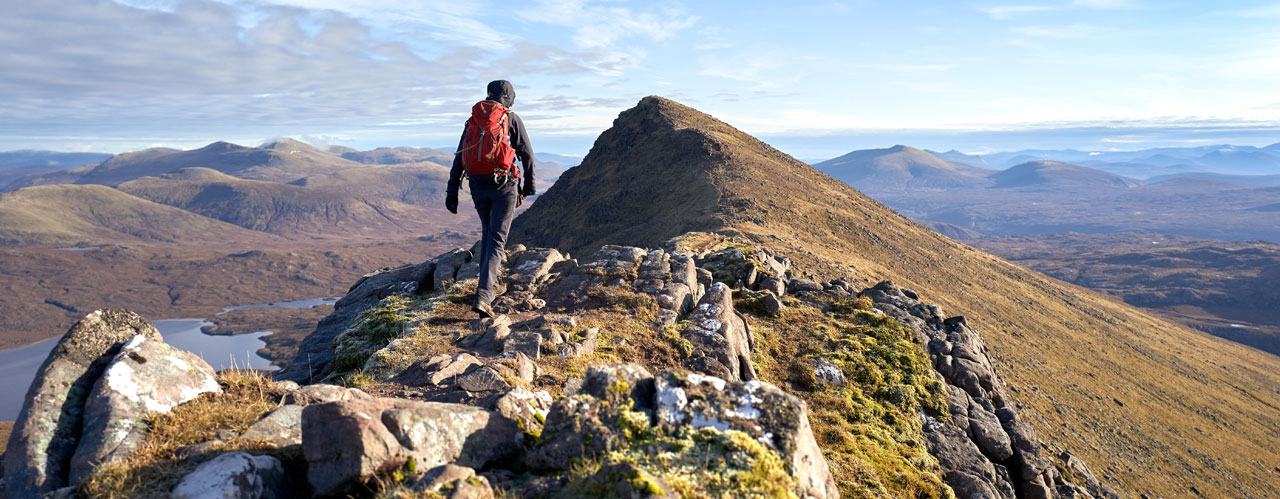
Guided Walking Holidays
Guided walking holidays on Wainright's Coast to Coast and the West Highland Way.
-
- Self-Guided Walking Holidays
-
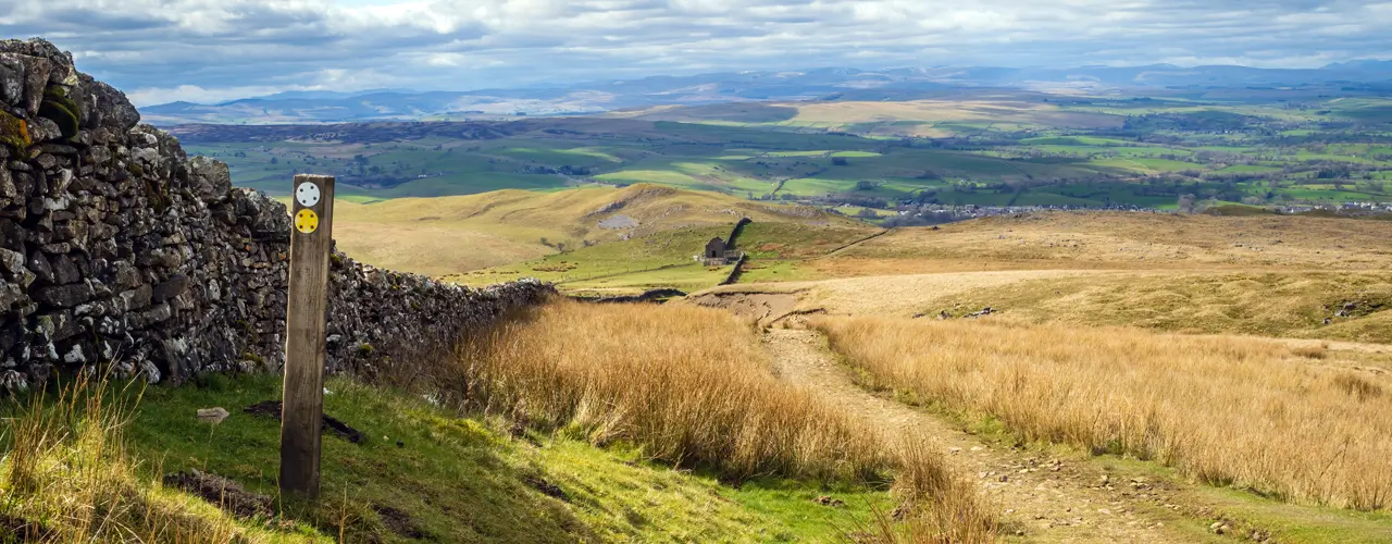
Self-Guided Walking Holidays
Self-Guided walking holidays on some of the UK’s most popular routes.
-
- FAQs
- Make Booking
- Contact Us
Northwestwalks, for walking holidays you can trust
-
9 Nights Accommodation/8 Days Walking
-
Coast to Coast East 9 Nights/8 Days Itinerary
- 9 Nights Accommodation
- 8 Days Walking
- Total distance 108 miles
9 Nights Accommodation/8 Days Walking
- Day 1 Travel to Kirkby Stephen where your first nights accommodation is booked
- Day 2 Kirkby Stephen to Keld - 13 miles
- Day 3 Keld to Reeth - 11 miles
- Day 4 Reeth to Richmond - 11 miles
- Day 5 Richmond to Danby Wiske - 13 miles
- Day 6 Danby Wiske to Ingleby Cross - 11 miles
- Day 7 Ingleby Cross to Clay Bank Top - 11 miles
- Day 8 Clay Bank Top to Glaisdale - 19 miles
- Day 9 Glaisdale to Robin Hoods Bay - 19 miles
- Day 10 Depart Robin Hoods Bay for home
Route Description
Kirkby Stephen (village height above sea level 180M) to Keld (350M). Distance 13 miles
Cross Franks Bridge and head for the lane which becomes a broad path onto the Pennine Moors and the summit of Nine Standards Rigg (662M). Depending on the time of year there are three routes over and around Nine Standards; green (avoiding the summit) for winter and spring, red for early summer, and blue for late summer and autumn. All routes cross peat, which is notoriously boggy in wet weather, before descending to the River Swale and the road in to Keld.
Keld (350M) to Reeth (200M). Distance 11 miles
From Keld you have a choice of routes. The main route stays high and crosses moorland that is scarred from a lead mining industry that disappeared at the end of the 19th century. From Keld the route descends to the river then climbs past Crackpot Hall and the ruins of Swinner Gill mine workings. It crosses the moor (580M) before dropping into Gunnerside Gill (400M) and then up onto Melbecks Moor (550M). From here a broad track descends gradually passing the ruins of Old Gang Smelting Mills to Surrender Bridge (350M) and another smelt mill. The last test of the day is to drop into Cringley Bottom, cross the river and then continue over the farmland to Reeth. The alternative route, is to follow the ‘royal road’ through Swaledale valley. The route passes through Gunnerside and a few pleasant small Yorkshire Dales villages.
Reeth (200M) to Richmond (150M). Distance 11 miles
This is a much easier day’s walk across rolling countryside passing Marrick Priory, Marske village and Whitecliffe wood to the largest town on route, Richmond.
Richmond (150M) to Danby Wiske (36M). Distance 13 miles
The route to Danby Wiske is almost level and generally easy going, it crosses farmlands to Bolton on Swale and then follows 7 miles of country lanes across the low lying Vale of Mowbray.
Danby Wiske (36M) to Ingleby Cross (80M). Distance 9 miles
The path remains easy going initially following the country lanes before returning to farm land. Take care crossing the busy A19 road.
Ingleby Cross (80M) to Clay Bank Top (250M). Distance 13 miles
This is the start of the crossing over the Cleveland Hills and the North York Moors, which are covered in purple heather during late summer months. The route follows the Cleveland Way trail and climbs steadily over Beacon Hill (299M) then descends into Scugdale (100M). The path climbs steadily at first then steeply onto Gold Hill (315M). It continues onto Carlton Moor (408M) before descending to Green Bank (300M). Once again it climbs going over Cringle Moor (430M), descends to 280M back up to 400M, down again to 300M and then a final climb through the Wainstones onto Hasty Bank (398M) before descending to the road at Clay Bank Top (250M). If all the up and down seems like too much hard work there is a path that contours round the hills from Green Bank to Clay Bank.
Clay Bank Top (250M) to Glaisdale (120M). Distance 19 miles
There is a steep ascent to Carr Ridge (390M) followed by a gradual rise to the summit of Round Hill (454M), the highest point on the North York Moors. The path descends to Bloworth Crossing (400M) were it leaves the Cleveland Way and continues on an almost level disused railway line across the desolate moors to the remote Lion Inn on Blakey Ridge. After a few miles alongside the road the route follows a track across the heather clad moors. There is another road walk and then the route continues along a broad disused track gradually descending Glaisdale Moor into Glaisdale village.
Glaisdale (120M) to Robin Hoods Bay. Distance 19 miles
The route follows the River Esk passing through East Arnecliffe Wood to Egton Bridge where it follows a once toll road through the private estate of Egton Manor to Grosmont.The road (the 1 in 3) climbs steeply out of Grosmont to its high point on Sleights Moor (285M). There are wonderful views to Whitby and the sea. The path descends through heather covered moorland in to Littlebeck. The route follows a woodland trail. After the woodland the path rises and crosses a final stretch of heather moorland before following country lanes to the coast. This time the path turns south to follow a coastal path to Robin Hoods Bay and a final last descent to the sea. Please don't forget to follow tradition once more by dipping your boot in the sea and throwing your pebble in (that should baffle the geologists in years to come). Your challenge is complete. Robin Hoods Bay is a picturesque once fishing village and reputed smugglers haunt. Being built on the hillside the street from top to bottom of the village is the final steep descent/ascent on route.
Booking
Our self guided holidays are booked on an individual basis and therefore you can start your holiday on any date of your choice between April and early October.
This Holiday Includes
- Carefully selected walker-friendly accommodation
- Breakfast each day
- Luggage transfer between overnight accommodation
- Route information and itinerary
- Detailed instructions to find your accommodation
- Guidebook with downloadable GPS waypoints and a route map
- Emergency contact 24 hours a day
- Holiday price £1005 per person based on two people sharing a room
- Single supplement £360
-
Coast to Coast East 8 Nights/7 Days Itinerary
- 8 Nights Accommodation
- 7 Days Walking
- Total distance 108 miles
8 Nights Accommodation/7 Days Walking
- Day 1 Travel to Kirkby Stephen where your first nights accommodation is booked
- Day 2 Kirkby Stephen to Keld - 13 miles
- Day 3 Keld to Reeth - 11 miles
- Day 4 Reeth to Richmond - 11 miles
- Day 5 Richmond to Ingleby Cross - 22 miles
- Day 6 Ingleby Cross to Clay Bank Top - 13 miles
- Day 7 Clay Bank Top to Glaisdale - 19 miles
- Day 8 Glaisdale to Robin Hoods Bay - 19 miles
- Day 9 Depart Robin Hoods Bay for home
Route Description
Kirkby Stephen (village height above sea level 180M) to Keld (350M). Distance 13 miles
Cross Franks Bridge and head for the lane which becomes a broad path onto the Pennine Moors and the summit of Nine Standards Rigg (662M). Depending on the time of year there are three routes over and around Nine Standards; green (avoiding the summit) for winter and spring, red for early summer, and blue for late summer and autumn. All routes cross peat, which is notoriously boggy in wet weather, before descending to the River Swale and the road in to Keld.
Keld (350M) to Reeth (200M). Distance 11 miles
From Keld you have a choice of routes. The main route stays high and crosses moorland that is scarred from a lead mining industry that disappeared at the end of the 19th century. From Keld the route descends to the river then climbs past Crackpot Hall and the ruins of Swinner Gill mine workings. It crosses the moor (580M) before dropping into Gunnerside Gill (400M) and then up onto Melbecks Moor (550M). From here a broad track descends gradually passing the ruins of Old Gang Smelting Mills to Surrender Bridge (350M) and another smelt mill. The last test of the day is to drop into Cringley Bottom, cross the river and then continue over the farmland to Reeth. The alternative route, is to follow the ‘royal road’ through Swaledale valley. The route passes through Gunnerside and a few pleasant small Yorkshire Dales villages.
Reeth (200M) to Richmond (150M). Distance 11 miles
This is a much easier day’s walk across rolling countryside passing Marrick Priory, Marske village and Whitecliffe wood to the largest town on route, Richmond.
Richmond (150M) to Ingleby Cross (80M). Distance 22 miles
The route to Ingleby Cross is almost level and generally easy going, it crosses farmlands to Bolton on Swale and then follows 7 miles of country lanes across the low lying Vale of Mowbray to Danby Wiske. The path remains easy going initially following the country lanes before returning to farm land. Take care crossing the busy A19 road.
Ingleby Cross (80M) to Clay Bank Top (250M). Distance 13 miles
This is the start of the crossing over the Cleveland Hills and the North York Moors, which are covered in purple heather during late summer months. The route follows the Cleveland Way trail and climbs steadily over Beacon Hill (299M) then descends into Scugdale (100M). The path climbs steadily at first then steeply onto Gold Hill (315M). It continues onto Carlton Moor (408M) before descending to Green Bank (300M). Once again it climbs going over Cringle Moor (430M), descends to 280M back up to 400M, down again to 300M and then a final climb through the Wainstones onto Hasty Bank (398M) before descending to the road at Clay Bank Top (250M). If all the up and down seems like too much hard work there is a path that contours round the hills from Green Bank to Clay Bank.
Clay Bank Top (250M) to Glaisdale (120M). Distance 19 miles
There is a steep ascent to Carr Ridge (390M) followed by a gradual rise to the summit of Round Hill (454M), the highest point on the North York Moors. The path descends to Bloworth Crossing (400M) were it leaves the Cleveland Way and continues on an almost level disused railway line across the desolate moors to the remote Lion Inn on Blakey Ridge. After a few miles alongside the road the route follows a track across the heather clad moors. There is another road walk and then the route continues along a broad disused track gradually descending Glaisdale Moor into Glaisdale village.
Glaisdale (120M) to Robin Hoods Bay. Distance 19 miles
The route follows the River Esk passing through East Arnecliffe Wood to Egton Bridge where it follows a once toll road through the private estate of Egton Manor to Grosmont.The road (the 1 in 3) climbs steeply out of Grosmont to its high point on Sleights Moor (285M). There are wonderful views to Whitby and the sea. The path descends through heather covered moorland in to Littlebeck. The route follows a woodland trail. After the woodland the path rises and crosses a final stretch of heather moorland before following country lanes to the coast. This time the path turns south to follow a coastal path to Robin Hoods Bay and a final last descent to the sea. Please don't forget to follow tradition once more by dipping your boot in the sea and throwing your pebble in (that should baffle the geologists in years to come). Your challenge is complete. Robin Hoods Bay is a picturesque once fishing village and reputed smugglers haunt. Being built on the hillside the street from top to bottom of the village is the final steep descent/ascent on route.
Booking
Our self guided holidays are booked on an individual basis and therefore you can start your holiday on any date of your choice between April and early October.
This Holiday Includes
- Carefully selected walker-friendly accommodation
Breakfast each day
Luggage transfer between overnight accommodation
Route information and itinerary
Detailed instructions to find your accommodation
Guidebook with downloadable GPS waypoints and a route map
Emergency contact 24 hours a day
Holiday price £955 per person based on two people sharing a room
Single supplement £320
-
Cumbria Way 6 Nights/5 Days Itinerary
- 6 Nights Accommodation
- 5 Days Walking
- Total distance 70 miles

6 Nights Accommodation/5 Days Walking
- Day 1 Travel to Ulverston where your first nights accommodation is booked
- Day 2 Ulverston to Coniston - 15 miles
- Day 3 Coniston to Langdales - 11 miles
- Day 4 Langdales to Keswick - 16 miles
- Day 5 Keswick to Caldbeck - 14 miles
- Day 6 Caldbeck to Carlisle - 14 miles
- Day 7 Depart Carlisle for home
Route Description
Ulverston (height above sea level 50m) to Coniston (60m). Distance 15 miles
The route leaves the Ulverston, birthplace of Stan Laurel, and heads north across farmland climbing to Higher Lath Farm (170m) then descending to pass St John’s Church in the hamlet of Broughton Beck (100m). Continuing across farmland the route enters the Lake District National Park near Gawthwaite (160m). The route continues passing farms and small hamlets to Tottlebank (145m) where it crosses low lying fells, passing Beacon Tarn (170m) on the way, before descending to Coniston Water (50m). The route follows a path along the western shore of Coniston Water to Coniston village (60m), in the shadow of Coniston Old Man fell.
Coniston (60m) to Langdale (90m). Distance 11 miles
The route leaves Coniston and climbs through woodland and fields to the stunning Tarn Hows. The route passes the tarn and joins a track through areas of woodland. It passes Great How and turns right to the villages of Colwith and Skelwith Bridge. The Langdale Pikes soon become visible as the route leaves Skelwith Bridge (50m). The route then turns left to follow the beck to the village of Elterwater before entering the Great Langdale valley. The route follows close to Great Langdale Beck, there are wonderful views on the fells on either side of the valley to Dungeon Ghyll (90M).
Langdale (90m) to Keswick (80m). Distance 16 miles
The route follows Mickleden Beck below the Langdale Pikes. The route climbs gradually at first then it turns north and climbs steeply alongside Stake Gill. It crosses the fell via Stake Pass (450m) before descending alongside Langstrath Beck and turning towards the villages of Stonethwaite. Here it joins Wainwright’s Coast to Coast Path to Rosthwaite (100m). The route follows the River Derwent through Borrowdale valley passing the village of Grange to Derwent Water where it follows the western shoreline to the town of Keswick (80m).
Keswick (80m) to Caldbeck (160m). Distance 15 miles
The route leaves Keswick and climbs past Latrigg fell on a path between Skiddaw and Blencathra Mountains. It continues to climb to Skiddaw House (470m) a former Shepherds Hut now a remote YHA bunkhouse. The route now splits to give two options. The high-level option (15 miles) follows the River Caldew down to 350m before ascending again to cross High Pike (658m) in the Caldbeck Fells. From here it is downhill to the village of Caldbeck (160m). The lower-level option (18 miles) descends on the access track to Peter House Farm (210m). The fellside route then contours round the back of the Lake District fells along sections of road walking and field paths to Caldbeck (160M).
Caldbeck (160m) to Carlisle (15m). Distance 14 miles
After leaving the village of Caldbeck this final low-level section of the route follows the course of the River Caldew to the city of Carlisle. The route passes through the villages of Sebergham and Dalston following woodland and farmland public footpaths and bridleways.
Booking
Our self guided holidays are booked on an individual basis and therefore you can start your holiday on any date of your choice between April and early October.
This Holiday Includes
6 nights accommodation with breakfast
Daily luggage transfer between accommodation
Guidebook & route map
Accommodation directions & holiday information
Emergency contact
Holiday price £750 per person based on two people sharing a room. Single supplement £350.
-

Great Glen Way 7 Nights/6 Days Itinerary
- 7 Nights Accommodation
- 6 Days Walking
- Total distance 79 miles
7 Nights Accommodation/6 Days Walking
- Day 1 Travel to Fort William where your first nights accommodation is booked
- Day 2 Fort William to Gairlochy - 11 miles
- Day 3 Gairlochy to Laggan - 13 miles
- Day 4 Laggan to Fort Augustus - 12 miles
- Day 5 Augustus to Invermoriston - 9 miles
- Day 6 Invermoriston to Drumnadrochit - 14 miles
- Day 7 Drumnadrochit to Inverness - 20 miles
- Day 8 Depart Inverness for home
Route Description
Fort William (height above sea level 10m) to Gairlochy (30m). Distance 11 miles.
The Great Glen Way starts at Fort William, a town on the shore of Loch Linnhe. The route out of Fort William takes you past the ruins of the 13th century Inverlochy Castle and onto the embankment of the Caledonian Canal. You follow the canal to the spectacular Neptune's Staircase, a tightly packed series of eight locks that raise the canal 64ft/20m. There are wonderful views of Ben Nevis. The route continues on a good path alongside the canal to Gairlochy.
Gairlochy (30m) to Laggan (30m). Distance 13 miles.
The Caledonian Canal meets Loch Lochy and you follow clear paths and forest tracks close to the shore of Loch Lochy. The Loch is said to be inhabited by a monster known as ‘Lizzie’. This is Clan Cameron territory and it is possible to take a detour to the Clan Cameron museum at Achnacarry. The route follows the Loch for approximately 10 miles to the next section of the Caledonian Canal at Laggan Locks.
Laggan (30m) to Fort Augustus (20m). Distance 12 miles.
The route follows a short section of canal which links Loch Lochy to Loch Oich. The 4 mile route alongside the Loch follows the course of an old railway line and stretches of General Wade’s military road. You arrive at the next section of the Caledonian Canal and the Great Glen Way follows the canal side path to the locks at Fort Augustus. Fort Augustus lies at the southern end of Loch Ness, home of the legendary Loch Ness Monster, ‘Nessie’.
Fort Augustus (20m) to Invermoriston (30m). Distance 9 miles.
This relatively easy section can be combined with the stretch from Laggan to Fort Augustus to create a ‘full day’s walk’. The route leads through Fort Augustus and a short climb brings you to a forest track. You follow paths and forest tracks above the shore of Loch Ness to Invermoriston. There is also an alternative high level route which climbs above the forest and offers more expansive views.
Invermoriston (30m) to Drumnadrochit (30m). Distance 14 miles.
The Great Glen Way continues to follow mainly forest tracks alongside Loch Ness from Invermoriston to Drumnadrochit. For the last section the route drifts away from Loch Ness and picks up the path of a minor road. As you approach Drumnadrochit you can detour to visit the ruins of Urquhart Castle, on the shore of Loch Ness. The 13th century castle was once one of the largest castles in Scotland. There is also a high level optional route from Invermoriston to Drumnadrochit.
Drumnadrochit (30m) to Inverness (10m). Distance 20 miles.
This is the longest and hardest section along the Great Glen Way. You have the option to complete this section in one day or split this section into two days. There is no accommodation along the route so return transfers from/to Blackfold and Drumnadrochit are included in the 8 night’s accommodation/7 days walking itinerary. You leave Drumnadrochit along the road and join the tracks through the forest. The tracks leave Loch Ness and climb to the highest point on route, 380M, in Abriachan Forest. You follow the course of an old drove road passing Blackfold. The route descends back into the Glen on the outskirts of Inverness. You cross the Caledonian Canal and then follow a path alongside the Rover Ness to finish at Inverness Castle.
Booking
Our self guided holidays are booked on an individual basis and therefore you can start your holiday on any date of your choice between April and early October.
This Holiday Includes
6 nights accommodation with breakfast
Daily luggage transfer between accommodation
Guidebook & route map
Accommodation directions & holiday information
Emergency contact
Holiday price £840 per person based on two people sharing a room. Single supplement £490.
-
Great Glen Way 6 Nights/5 Days Itinerary
- 6 Nights Accommodation
- 5 Days Walking
- Total distance 79 miles
6 Nights Accommodation/5 Days Walking
- Day 1 Travel to Fort William where your first nights accommodation is booked
- Day 2 Fort William to Gairlochy - 11 miles
- Day 3 Gairlochy to Laggan - 13 miles
- Day 4 Laggan to Invermoriston - 21 miles
- Day 5 Invermoriston to Drumnadrochit - 14 miles
- Day 6 Drumnadrochit to Inverness - 20 miles
- Day 7 Depart Inverness for home
Route Description
Fort William (height above sea level 10m) to Gairlochy (30m). Distance 11 miles.
The Great Glen Way starts at Fort William, a town on the shore of Loch Linnhe. The route out of Fort William takes you past the ruins of the 13th century Inverlochy Castle and onto the embankment of the Caledonian Canal. You follow the canal to the spectacular Neptune's Staircase, a tightly packed series of eight locks that raise the canal 64ft/20m. There are wonderful views of Ben Nevis. The route continues on a good path alongside the canal to Gairlochy.
Gairlochy (30m) to Laggan (30m). Distance 13 miles.
The Caledonian Canal meets Loch Lochy and you follow clear paths and forest tracks close to the shore of Loch Lochy. The Loch is said to be inhabited by a monster known as ‘Lizzie’. This is Clan Cameron territory and it is possible to take a detour to the Clan Cameron museum at Achnacarry. The route follows the Loch for approximately 10 miles to the next section of the Caledonian Canal at Laggan Locks.
Laggan (30m) to Invermoriston (30m). Distance 21 miles.
The route follows a short section of canal which links Loch Lochy to Loch Oich. The 4 mile route alongside the Loch follows the course of an old railway line and stretches of General Wade’s military road. You arrive at the next section of the Caledonian Canal and the Great Glen Way follows the canal side path to the locks at Fort Augustus. Fort Augustus lies at the southern end of Loch Ness, home of the legendary Loch Ness Monster, ‘Nessie’. The route leads through Fort Augustus and a short climb brings you to a forest track. You follow paths and forest tracks above the shore of Loch Ness to Invermoriston. There is also an alternative high level route which climbs above the forest and offers more expansive views.
Invermoriston (30m) to Drumnadrochit (30m). Distance 14 miles.
The Great Glen Way continues to follow mainly forest tracks alongside Loch Ness from Invermoriston to Drumnadrochit. For the last section the route drifts away from Loch Ness and picks up the path of a minor road. As you approach Drumnadrochit you can detour to visit the ruins of Urquhart Castle, on the shore of Loch Ness. The 13th century castle was once one of the largest castles in Scotland. There is also a high level optional route from Invermoriston to Drumnadrochit.
Drumnadrochit (30m) to Inverness (10m). Distance 20 miles.
This is the longest and hardest section along the Great Glen Way. You have the option to complete this section in one day or split this section into two days. There is no accommodation along the route so return transfers from/to Blackfold and Drumnadrochit are included in the 8 night’s accommodation/7 days walking itinerary. You leave Drumnadrochit along the road and join the tracks through the forest. The tracks leave Loch Ness and climb to the highest point on route, 380M, in Abriachan Forest. You follow the course of an old drove road passing Blackfold. The route descends back into the Glen on the outskirts of Inverness. You cross the Caledonian Canal and then follow a path alongside the Rover Ness to finish at Inverness Castle.
Booking
Our self guided holidays are booked on an individual basis and therefore you can start your holiday on any date of your choice between April and early October.
This Holiday Includes
6 nights accommodation with breakfast
Daily luggage transfer between accommodation
Guidebook & route map
Accommodation directions & holiday information
Emergency contact
Holiday price £750 per person based on two people sharing a room. Single supplement £360.
-
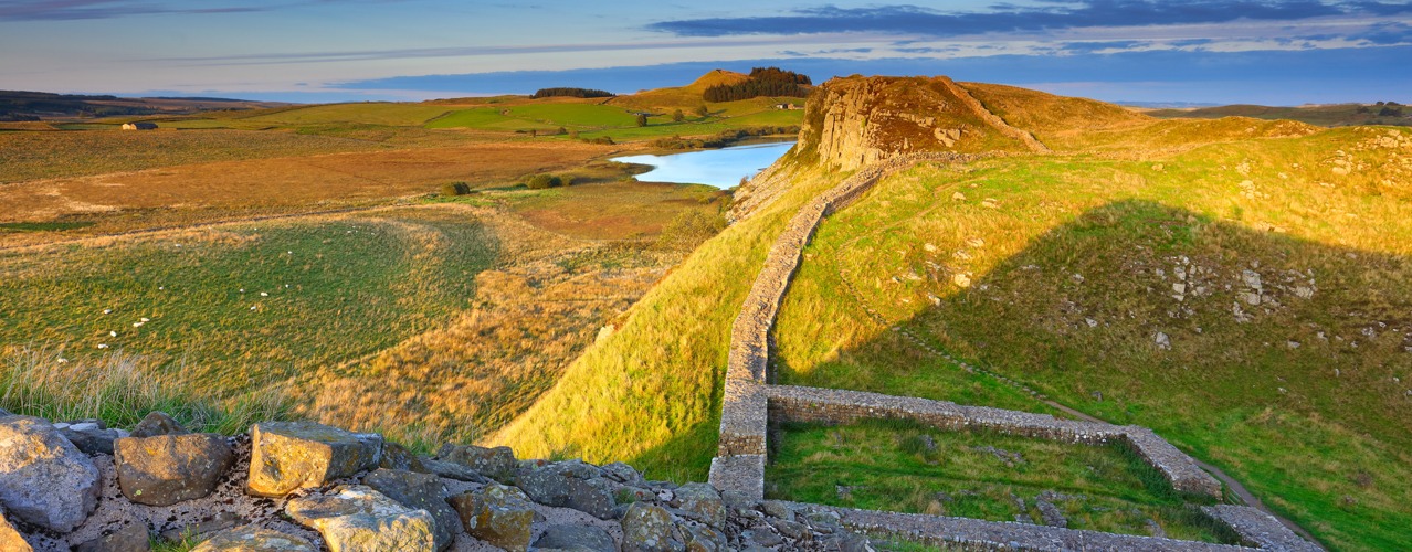
Hadrian's Wall East to West
9 Nights/8 Days Itinerary- 9 Nights Accommodation
- 8 Days Walking
- Total distance 84 miles

9 Nights Accommodation/8 Days Walking
- Day 1 Travel to Newcastle where your first nights accommodation is booked
- Day 2 Wallsend to Newburn - 11 miles
- Day 3 Newburn to East Wallhouses - 10 miles
- Day 4 East Wallhouses to Chollerford - 9 miles
- Day 5 Chollerford to Steel Rigg - 12 miles
- Day 6 Steel Rigg to Gilsland - 8 miles
- Day 7 Gilsland to Newtown - 11 miles
- Day 8 Newtown to Carlisle - 8 miles
- Day 9 Carlisle to Bowness-on-Solway - 15 miles
- Day 10 Depart Bowness-on-Solway for home
Route Description
Wallsend (height above sea level 5m) to Newburn (5m). Distance 11 miles.
The start of Hadrian’s Wall Path is in Wallsend, Newcastle at the remains of Segedunum Roman Fort. Not since the end of the Roman occupation of Britain, some 1600 years ago, has it been possible to walk along the entire length of Hadrian's Wall. The first section of the route from Wallsend to Chollerford is generally easy walking. From the fort the route follows alongside the River Tyne, passing the shipyards and Newcastle’s industrial centre for the first several miles. The route leads through Newcastle Quayside, a vibrant area with restaurants and cafes. The bridges, including the tilting Millennium Bridge ('Winking Eye Bridge') link Newcastle to Gateshead. Continuing to follow the direction of the river the route passes Newburn (5m).
Newburn (5m) to East Wallhouses (140m). Distance 10 miles.
In a few miles the route meets the Wylam Waggonway. Hadrian’s Wall path turns right away from the river to Heddon-on-the-Wall, a short walk across farmland, but continuing along the Waggonway for a short distance brings you to Wylam birthplace of George Stephenson. At Heddon-on-the-Wall is the first section of the Wall and evidence of Roman construction. From Heddon-on-the-Wall the path leads into the countryside and continues its way over mainly level terrain alongside the line of the old military road, where the Wall once stood. To the north side of the road you will see the ditch in places and the occasional ridge in the fields to the south. Today the B6318 road is dubbed the military road, not on account of the Romans, rather General Wade, builder of military supply roads in the 18th century in response to the Jacobite rebellion. The route is almost straight as it leads to the hamlet of East Wallhouses.
East Wallhouses (140m) to Chollerford (100m). Distance 9 miles.
From East Wallhouses the route continues in an almost straight line. At the junction with the A68 road is Portgate (200m), which was the junction with the Wall and Dere Street, the main Roman road into Scotland. The historical market town of Corbridge is a few miles to the south of the path. The path passes St. Oswald’s Church at Heavenfield (220m), the site of a 7th century battle between Northumbrian forces and an invading Welsh army. The battle was a decisive victory for Oswald, King of Northumbria. The 97 mile St. Oswald’s Way long distance walking route leads from Holy Island to Heavenfield, and Hadrian’s Wall path and St Oswald’s Way have been following the same path for the last few miles. The route passes close to the village of Wall and then leads a mile to Chollerford. Here are the ruins of Chesters Roman Fort and Chesters Museum, open daily from April to September.
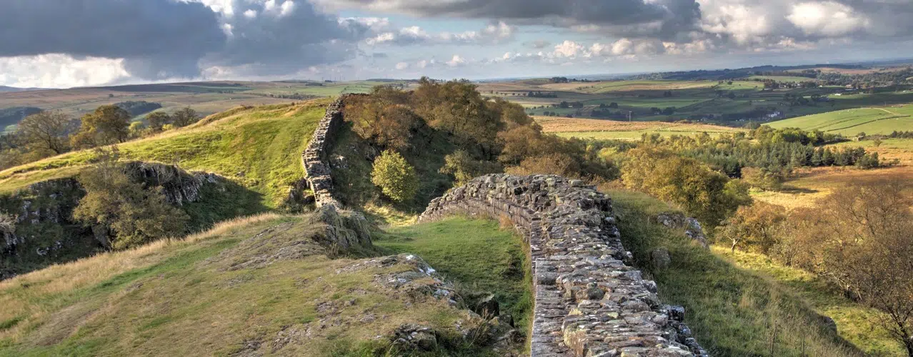
Chollerford (100m) to Steel Rigg (280m). Distance 12 miles.
On this stage there are the most complete sections of the Wall, forts, milecastles, turret sections and wonderful views as the Wall crosses the Pennine Hills. The path continues to follow the line of the military road for several miles and climbs gradually as it ascends into the Pennine’s. The path passes Limestone Corner, the most northerly point of the Wall. Near milecastle 34 (250m) the road turns away from Hadrian’s Wall and the Wall crosses the rough and rugged landscape of the Pennine Hills. The Wall was built on a line of rocky Crags which created a high defence to potential invaders from the north. There are excellent views of the surrounding area and Northumberland National Park. For the next several miles the path rises and falls as it crosses the Crags, passing Housesteads Fort (275m) on route to Steel Rigg. Approximately 2 miles from this point is Vindolanda Fort, both Vindolanda and Housesteads are open daily from April to September.
Steel Rigg (280m) to Gilsland (130m). Distance 8 miles.
For the next few miles Hadrian’s Wall Path continues its route over the Crags alongside good sections of the Wall. The path reaches its highest point at Windshields Crags (345m). There isn't very much between yourself and the Shetlands, a wasteland occupied by ‘The Barbarians’, or so the Romans called them, two millennia ago. This section of the path is also shared for a few miles by 268 mile Pennine Way long distance National Trail, an upland walking route which leads from Edale in Derbyshire to Kirk Yetholm in the Scottish Borders. At Walltown Crags there are views of southern Scotland and the Northern Pennines, and in the distance the Solway Firth. The landscape changes and the path crosses into Cumbria and over farmland to the village of Gilsland (130m).
Gilsland (130m) to Newtown (70m). Distance 11 miles.
A mile from Gilsland is Birdoswald Fort (open daily from April to September). Hadrian’s Wall path now continues across farmland to the hamlet of Banks (120m). Continuing over farmland there are no ruins of wall or forts to be seen on this section of the walk, but the occasional humps and bumps in the ground and glimpse of vallum ditch show the line of the Wall. A few miles after Banks is the village of Walton (80m) and shortly after the village of Newtown (70m).
Newtown (70m) to Carlisle (15m). Distance 8 miles.
The terrain levels and in a few miles meets the River Eden at Crosby-on-Eden (30m). From here the path alternates from roadside to riverside walking as it makes its way to the border City of Carlisle, close to the Scottish border. The Romans established a settlement here to serve the forts on Hadrian’s Wall. Carlisle Castle is a great medieval fortress which houses the Border Regiment Museum. Carlisle is also at the end of the 70 mile Cumbria Way long distance walking route which crosses the Lake District from Ulverston at the southern end.
Carlisle (15m) to Bowness-on-Solway (5m). Distance 15 miles.
The Path leaves Carlisle alongside the banks of the River Eden, which is winding its way to the Solway Estuary. The walking is almost level. A few miles out of Carlisle the path leaves the river to pass through the village of Burgh by Sands (20m). For the last 7 or 8 miles to Bowness-on-Solway the path follows a road alongside the peaceful Solway Estuary. There are wonderful views across the estuary to the hills in Southern Scotland. In the village of Bowness-on-Solway a small shelter and pretty garden mark the end of the walk alongside this historic ancient frontier.
Booking
Our self guided holidays are booked on an individual basis and therefore you can start your holiday on any date of your choice between April and early October.
This Holiday Includes
9 nights accommodation with breakfast
Daily luggage transfer between accommodation
Guidebook & route map
Accommodation directions & holiday information
Emergency contact
Holiday price £965 per person based on two people sharing a room. Single supplement £450.
-
Hadrian's Wall East to West
8 Nights/7 Days Itinerary- 8 Nights Accommodation
- 7 Days Walking
- Total distance 84 miles
8 Nights Accommodation/7 Days Walking
- Day 1 Travel to Newcastle where your first nights accommodation is booked
- Day 2 Wallsend to Heddon-on-the-Wall/Wylam - 15 miles
- Day 3 Heddon-on-the-Wall/Wylam to Chollerford - 15 miles
- Day 4 Chollerford to Steel Rigg - 12 miles
- Day 5 Steel Rigg to Gilsland - 8 miles
- Day 6 Gilsland to Newtown - 11 miles
- Day 7 Newtown to Carlisle - 8 miles
- Day 8 Carlisle to Bowness-on-Solway - 15 miles
- Day 9 Depart Bowness-on-Solway for home
Route Description
Wallsend (height above sea level 5m) to Wylam (10m)/Heddon-on-the-Wall (120m). Distance 15 miles.
The start of Hadrian’s Wall Path is in Wallsend, Newcastle at the remains of Segedunum Roman Fort. Not since the end of the Roman occupation of Britain, some 1600 years ago, has it been possible to walk along the entire length of Hadrian's Wall. The first section of the route from Wallsend to Chollerford is generally easy walking. From the fort the route follows alongside the River Tyne, passing the shipyards and Newcastle’s industrial centre for the first several miles. The route leads through Newcastle Quayside, a vibrant area with restaurants and cafes. The bridges, including the tilting Millennium Bridge ('Winking Eye Bridge') link Newcastle to Gateshead. Continuing to follow the direction of the river the route passes Newburn (5m). In a few miles the route meets the Wylam Waggonway. Hadrian’s Wall path turns right away from the river to Heddon-on-the-Wall, a short walk across farmland, but continuing along the Waggonway for a short distance brings you to Wylam birthplace of George Stephenson. At Heddon-on-the-Wall is the first section of the Wall and evidence of Roman construction.
Wylam (10m)/Heddon-on-the-Wall (120m) to Chollerford (100m) Distance 15 miles.
From Heddon-on-the-Wall the path leads into the countryside and continues its way over mainly level terrain alongside the line of the old military road, where the Wall once stood. To the north side of the road you will see the ditch in places and the occasional ridge in the fields to the south. Today the B6318 road is dubbed the military road, not on account of the Romans, rather General Wade, builder of military supply roads in the 18th century in response to the Jacobite rebellion. The route is almost straight and passes the hamlets of Wallhouses and Halton Red House. At the junction with the A68 road is Portgate (200m), which was the junction with the Wall and Dere Street, the main Roman road into Scotland. The historical market town of Corbridge is a few miles to the south of the path. The path passes St. Oswald’s Church at Heavenfield (220m), the site of a 7th century battle between Northumbrian forces and an invading Welsh army. The battle was a decisive victory for Oswald, King of Northumbria. The 97 mile St. Oswald’s Way long distance walking route leads from Holy Island to Heavenfield, and Hadrian’s Wall path and St Oswald’s Way have been following the same path for the last few miles. The route passes close to the village of Wall and then leads a mile to Chollerford. Here are the ruins of Chesters Roman Fort and Chesters Museum, open daily from April to September.
Chollerford (100m) to Steel Rigg (280m). Distance 12 miles.
On this stage there are the most complete sections of the Wall, forts, milecastles, turret sections and wonderful views as the Wall crosses the Pennine Hills. The path continues to follow the line of the military road for several miles and climbs gradually as it ascends into the Pennine’s. The path passes Limestone Corner, the most northerly point of the Wall. Near milecastle 34 (250m) the road turns away from Hadrian’s Wall and the Wall crosses the rough and rugged landscape of the Pennine Hills. The Wall was built on a line of rocky Crags which created a high defence to potential invaders from the north. There are excellent views of the surrounding area and Northumberland National Park. For the next several miles the path rises and falls as it crosses the Crags, passing Housesteads Fort (275m) on route to Steel Rigg. Approximately 2 miles from this point is Vindolanda Fort, both Vindolanda and Housesteads are open daily from April to September.
Steel Rigg (280m) to Gilsland (130m). Distance 8 miles.
For the next few miles Hadrian’s Wall Path continues its route over the Crags alongside good sections of the Wall. The path reaches its highest point at Windshields Crags (345m). There isn't very much between yourself and the Shetlands, a wasteland occupied by ‘The Barbarians’, or so the Romans called them, two millennia ago. This section of the path is also shared for a few miles by 268 mile Pennine Way long distance National Trail, an upland walking route which leads from Edale in Derbyshire to Kirk Yetholm in the Scottish Borders. At Walltown Crags there are views of southern Scotland and the Northern Pennines, and in the distance the Solway Firth. The landscape changes and the path crosses into Cumbria and over farmland to the village of Gilsland (130m).
Gilsland (130m) to Newtown (70m). Distance 11 miles.
A mile from Gilsland is Birdoswald Fort (open daily from April to September). Hadrian’s Wall path now continues across farmland to the hamlet of Banks (120m). Continuing over farmland there are no ruins of wall or forts to be seen on this section of the walk, but the occasional humps and bumps in the ground and glimpse of vallum ditch show the line of the Wall. A few miles after Banks is the village of Walton (80m) and shortly after the village of Newtown (70m).
Newtown (70m) to Carlisle (15m). Distance 8 miles.
The terrain levels and in a few miles meets the River Eden at Crosby-on-Eden (30m). From here the path alternates from roadside to riverside walking as it makes its way to the border City of Carlisle, close to the Scottish border. The Romans established a settlement here to serve the forts on Hadrian’s Wall. Carlisle Castle is a great medieval fortress which houses the Border Regiment Museum. Carlisle is also at the end of the 70 mile Cumbria Way long distance walking route which crosses the Lake District from Ulverston at the southern end.
Carlisle (15m) to Bowness-on-Solway (5m). Distance 15 miles.
The Path leaves Carlisle alongside the banks of the River Eden, which is winding its way to the Solway Estuary. The walking is almost level. A few miles out of Carlisle the path leaves the river to pass through the village of Burgh by Sands (20m). For the last 7 or 8 miles to Bowness-on-Solway the path follows a road alongside the peaceful Solway Estuary. There are wonderful views across the estuary to the hills in Southern Scotland. In the village of Bowness-on-Solway a small shelter and pretty garden mark the end of the walk alongside this historic ancient frontier.
Booking
Our self guided holidays are booked on an individual basis and therefore you can start your holiday on any date of your choice between April and early October.
This Holiday Includes
8 nights accommodation with breakfast
Daily luggage transfer between accommodation
Guidebook & route map
Accommodation directions & holiday information
Emergency contact
Holiday price £860 per person based on two people sharing a room. Single supplement £400.
-
Hadrian's Wall East to West
7 Nights/6 Days Itinerary- 7 Nights Accommodation
- 6 Days Walking
- Total distance 84 miles
7 Nights Accommodation/6 Days Walking
- Day 1 Travel to Newcastle where your first nights accommodation is booked
- Day 2 Wallsend to Heddon-on-the-Wall/Wylam - 15 miles
- Day 3 Wylam/Heddon-on-the-Wall to Chollerford - Distance 15 miles.
- Day 4 Chollerford to Steel Rigg - 12 miles
- Day 5 Steel Rigg to Gilsland - 8 miles
- Day 6 Gilsland to Carlisle - 19 miles
- Day 7 Carlisle to Bowness-on-Solway - 15 miles
- Day 8 Depart Bowness-on-Solway for home
Route Description
Wallsend (height above sea level 5m) to Wylam (10m)/Heddon-on-the-Wall (120m). Distance 15 miles.
The start of Hadrian’s Wall Path is in Wallsend, Newcastle at the remains of Segedunum Roman Fort. Not since the end of the Roman occupation of Britain, some 1600 years ago, has it been possible to walk along the entire length of Hadrian's Wall. The first section of the route from Wallsend to Chollerford is generally easy walking. From the fort the route follows alongside the River Tyne, passing the shipyards and Newcastle’s industrial centre for the first several miles. The route leads through Newcastle Quayside, a vibrant area with restaurants and cafes. The bridges, including the tilting Millennium Bridge ('Winking Eye Bridge') link Newcastle to Gateshead. Continuing to follow the direction of the river the route passes Newburn (5m). In a few miles the route meets the Wylam Waggonway. Hadrian’s Wall path turns right away from the river to Heddon-on-the-Wall, a short walk across farmland, but continuing along the Waggonway for a short distance brings you to Wylam birthplace of George Stephenson. At Heddon-on-the-Wall is the first section of the Wall and evidence of Roman construction.
Wylam (10m)/Heddon-on-the-Wall (120m) to Chollerford (100m). Distance 15 miles.
From Heddon-on-the-Wall the path leads into the countryside and continues its way over mainly level terrain alongside the line of the old military road, where the Wall once stood. To the north side of the road you will see the ditch in places and the occasional ridge in the fields to the south. Today the B6318 road is dubbed the military road, not on account of the Romans, rather General Wade, builder of military supply roads in the 18th century in response to the Jacobite rebellion. The route is almost straight and passes the hamlets of Wallhouses and Halton Red House. At the junction with the A68 road is Portgate (200m), which was the junction with the Wall and Dere Street, the main Roman road into Scotland. The historical market town of Corbridge is a few miles to the south of the path. The path passes St. Oswald’s Church at Heavenfield (220m), the site of a 7th century battle between Northumbrian forces and an invading Welsh army. The battle was a decisive victory for Oswald, King of Northumbria. The 97 mile St. Oswald’s Way long distance walking route leads from Holy Island to Heavenfield, and Hadrian’s Wall path and St Oswald’s Way have been following the same path for the last few miles. The route passes close to the village of Wall and then leads a mile to Chollerford. Here are the ruins of Chesters Roman Fort and Chesters Museum, open daily from April to September.
Chollerford (100m) to Steel Rigg (280m). Distance 12 miles.
On this stage there are the most complete sections of the Wall, forts, milecastles, turret sections and wonderful views as the Wall crosses the Pennine Hills. The path continues to follow the line of the military road for several miles and climbs gradually as it ascends into the Pennine’s. The path passes Limestone Corner, the most northerly point of the Wall. Near milecastle 34 (250m) the road turns away from Hadrian’s Wall and the Wall crosses the rough and rugged landscape of the Pennine Hills. The Wall was built on a line of rocky Crags which created a high defence to potential invaders from the north. There are excellent views of the surrounding area and Northumberland National Park. For the next several miles the path rises and falls as it crosses the Crags, passing Housesteads Fort (275m) on route to Steel Rigg. Approximately 2 miles from this point is Vindolanda Fort, both Vindolanda and Housesteads are open daily from April to September.
Steel Rigg (280m) to Gilsland (130m). Distance 8 miles.
For the next few miles Hadrian’s Wall Path continues its route over the Crags alongside good sections of the Wall. The path reaches its highest point at Windshields Crags (345m). There isn't very much between yourself and the Shetlands, a wasteland occupied by ‘The Barbarians’, or so the Romans called them, two millennia ago. This section of the path is also shared for a few miles by 268 mile Pennine Way long distance National Trail, an upland walking route which leads from Edale in Derbyshire to Kirk Yetholm in the Scottish Borders. At Walltown Crags there are views of southern Scotland and the Northern Pennines, and in the distance the Solway Firth. The landscape changes and the path crosses into Cumbria and over farmland to the village of Gilsland (130m).
Gilsland (130m) to Carlisle (15m). Distance 19 miles.
A mile from Gilsland is Birdoswald Fort (open daily from April to September). Hadrian’s Wall path now continues across farmland to the hamlet of Banks (120m). Continuing over farmland there are no ruins of wall or forts to be seen on this section of the walk, but the occasional humps and bumps in the ground and glimpse of vallum ditch show the line of the Wall. A few miles after Banks is the village of Walton (80m) and shortly after the village of Newtown (70m). The terrain levels and in a few miles meets the River Eden at Crosby-on-Eden (30m). From here the path alternates from roadside to riverside walking as it makes its way to the border City of Carlisle, close to the Scottish border. The Romans established a settlement here to serve the forts on Hadrian’s Wall. Carlisle Castle is a great medieval fortress which houses the Border Regiment Museum. Carlisle is also at the end of the 70 mile Cumbria Way long distance walking route which crosses the Lake District from Ulverston at the southern end.
Carlisle (15m) to Bowness-on-Solway (5m). Distance 15 miles.
The Path leaves Carlisle alongside the banks of the River Eden, which is winding its way to the Solway Estuary. The walking is almost level. A few miles out of Carlisle the path leaves the river to pass through the village of Burgh by Sands (20m). For the last 7 or 8 miles to Bowness-on-Solway the path follows a road alongside the peaceful Solway Estuary. There are wonderful views across the estuary to the hills in Southern Scotland. In the village of Bowness-on-Solway a small shelter and pretty garden mark the end of the walk alongside this historic ancient frontier.
Booking
Our self guided holidays are booked on an individual basis and therefore you can start your holiday on any date of your choice between April and early October.
This Holiday Includes
7 nights accommodation with breakfast
Daily luggage transfer between accommodation
Guidebook & route map
Accommodation directions & holiday information
Emergency contact
Holiday price £755 per person based on two people sharing a room. Single supplement £350.
-
Hadrian's Wall East to West
6 Nights/5 Days Itinerary- 6 Nights Accommodation
- 5 Days Walking
- Total distance 84 miles
6 Nights Accommodation/5 Days Walking
- Day 1 Travel to Newcastle where your first nights accommodation is booked
- Day 2 Wallsend to Wylam/Heddon-on-the-Wall (120m) - Distance 15 miles.
- Day 3 Wylam/Heddon-on-the-Wall to Chollerford - Distance 15 miles.
- Day 4 Chollerford to Gilsland - 20 miles
- Day 5 Gilsland to Carlisle - 19 miles
- Day 6 Carlisle to Bowness-on-Solway - 15 miles
- Day 7 Depart Bowness-on-Solway for home
Route Description
Wallsend (height above sea level 5m) to Wylam (10m)/Heddon-on-the-Wall (120m). Distance 15 miles.
The start of Hadrian’s Wall Path is in Wallsend, Newcastle at the remains of Segedunum Roman Fort. Not since the end of the Roman occupation of Britain, some 1600 years ago, has it been possible to walk along the entire length of Hadrian's Wall. The first section of the route from Wallsend to Chollerford is generally easy walking. From the fort the route follows alongside the River Tyne, passing the shipyards and Newcastle’s industrial centre for the first several miles. The route leads through Newcastle Quayside, a vibrant area with restaurants and cafes. The bridges, including the tilting Millennium Bridge ('Winking Eye Bridge') link Newcastle to Gateshead. Continuing to follow the direction of the river the route passes Newburn (5m). In a few miles the route meets the Wylam Waggonway. Hadrian’s Wall path turns right away from the river to Heddon-on-the-Wall, a short walk across farmland, but continuing along the Waggonway for a short distance brings you to Wylam birthplace of George Stephenson. At Heddon-on-the-Wall is the first section of the Wall and evidence of Roman construction.
Wylam (10m)/Heddon-on-the-Wall (120m) to Chollerford (100m). Distance 15 miles.
From Heddon-on-the-Wall the path leads into the countryside and continues its way over mainly level terrain alongside the line of the old military road, where the Wall once stood. To the north side of the road you will see the ditch in places and the occasional ridge in the fields to the south. Today the B6318 road is dubbed the military road, not on account of the Romans, rather General Wade, builder of military supply roads in the 18th century in response to the Jacobite rebellion. The route is almost straight and passes the hamlets of Wallhouses and Halton Red House. At the junction with the A68 road is Portgate (200m), which was the junction with the Wall and Dere Street, the main Roman road into Scotland. The historical market town of Corbridge is a few miles to the south of the path. The path passes St. Oswald’s Church at Heavenfield (220m), the site of a 7th century battle between Northumbrian forces and an invading Welsh army. The battle was a decisive victory for Oswald, King of Northumbria. The 97 mile St. Oswald’s Way long distance walking route leads from Holy Island to Heavenfield, and Hadrian’s Wall path and St Oswald’s Way have been following the same path for the last few miles. The route passes close to the village of Wall and then leads a mile to Chollerford. Here are the ruins of Chesters Roman Fort and Chesters Museum, open daily from April to September.
Chollerford (100m) to Gilsland (130m). Distance 20 miles.
On this stage there are the most complete sections of the Wall, forts, milecastles, turret sections and wonderful views as the Wall crosses the Pennine Hills. The path continues to follow the line of the military road for several miles and climbs gradually as it ascends into the Pennine’s. The path passes Limestone Corner, the most northerly point of the Wall. Near milecastle 34 (250m) the road turns away from Hadrian’s Wall and the Wall crosses the rough and rugged landscape of the Pennine Hills. The Wall was built on a line of rocky Crags which created a high defence to potential invaders from the north. There are excellent views of the surrounding area and Northumberland National Park. For the next several miles the path rises and falls as it crosses the Crags, passing Housesteads Fort (275m) on route to Steel Rigg. Approximately 2 miles from this point is Vindolanda Fort, both Vindolanda and Housesteads are open daily from April to September. For the next few miles Hadrian’s Wall Path continues its route over the Crags alongside good sections of the Wall. The path reaches its highest point at Windshields Crags (345m). There isn't very much between yourself and the Shetlands, a wasteland occupied by ‘The Barbarians’, or so the Romans called them, two millennia ago. This section of the path is also shared for a few miles by 268 mile Pennine Way long distance National Trail, an upland walking route which leads from Edale in Derbyshire to Kirk Yetholm in the Scottish Borders. At Walltown Crags there are views of southern Scotland and the Northern Pennines, and in the distance the Solway Firth. The landscape changes and the path crosses into Cumbria and over farmland to the village of Gilsland (130m).
Gilsland (130m) to Carlisle (15m). Distance 19 miles.
A mile from Gilsland is Birdoswald Fort (open daily from April to September). Hadrian’s Wall path now continues across farmland to the hamlet of Banks (120m). Continuing over farmland there are no ruins of wall or forts to be seen on this section of the walk, but the occasional humps and bumps in the ground and glimpse of vallum ditch show the line of the Wall. A few miles after Banks is the village of Walton (80m) and shortly after the village of Newtown (70m). The terrain levels and in a few miles meets the River Eden at Crosby-on-Eden (30m). From here the path alternates from roadside to riverside walking as it makes its way to the border City of Carlisle, close to the Scottish border. The Romans established a settlement here to serve the forts on Hadrian’s Wall. Carlisle Castle is a great medieval fortress which houses the Border Regiment Museum. Carlisle is also at the end of the 70 mile Cumbria Way long distance walking route which crosses the Lake District from Ulverston at the southern end.
Carlisle (15m) to Bowness-on-Solway (5m). Distance 15 miles.
The Path leaves Carlisle alongside the banks of the River Eden, which is winding its way to the Solway Estuary. The walking is almost level. A few miles out of Carlisle the path leaves the river to pass through the village of Burgh by Sands (20m). For the last 7 or 8 miles to Bowness-on-Solway the path follows a road alongside the peaceful Solway Estuary. There are wonderful views across the estuary to the hills in Southern Scotland. In the village of Bowness-on-Solway a small shelter and pretty garden mark the end of the walk alongside this historic ancient frontier.
Booking
Our self guided holidays are booked on an individual basis and therefore you can start your holiday on any date of your choice between April and early October.
This Holiday Includes
- 6 nights accommodation with breakfast
- Daily luggage transfer between accommodation
- Guidebook & route map
- Accommodation directions & holiday information
- Emergency contact
- Holiday price £650 per person based on two people sharing a room. Single supplement £300.
-

Hadrian's Wall West to East
9 Nights/8 Days Itinerary- 9 Nights Accommodation
- 8 Days Walking
- Total distance 84 miles
9 Nights Accommodation/8 Days Walking
- Day 1 Travel to Bowness-on-Solway where your first nights accommodation is booked
- Day 2 Bowness-on-Solway to Carlisle - 15 miles
- Day 3 Carlisle to Newtown - 8 miles
- Day 4 Newtown to Gilsland - 11 miles
- Day 5 Gilsland to Steel Rigg - 8 miles
- Day 6 Steel Rigg to Chollerford - 12 miles
- Day 7 Chollerford to East Wallhouses - 9 miles
- Day 8 East Wallhouses to Newburn - 10 miles
- Day 9 Newburn to Wallsend - 11 miles
- Day 10 Depart Newcastle for home
Route Description
Bowness-on-Solway (height above sea level 5m) to Carlisle (15m). Distance 15 miles.
Walking West to East, a small shelter and pretty garden in the village of Bowness-on-Solway mark the start of Hadrian’s Wall Path. Not since the end of the Roman occupation of Britain, some 1600 years ago, has it been possible to walk along the entire length of Hadrian's Wall. The route to Carlisle is almost level. The first 7 or 8 miles follow a roadside path alongside the peaceful Solway Estuary. There are wonderful views across the estuary to the hills in Southern Scotland. The path passes through the village of Burgh by Sands (20m) and shortly after follows the River Eden to Carlisle. The border City of Carlisle is close to the Scottish border. The Romans established a settlement here to serve the forts on Hadrian’s Wall. Carlisle Castle is a great medieval fortress which houses the Border Regiment Museum. Carlisle is also at the end of the 70 mile Cumbria Way long distance walking route which crosses the Lake District from Ulverston at the southern end.
Carlisle (15m) to Newtown (70m). Distance 8 miles.
From Carlisle the path alternates from riverside to roadside walking as it makes its way to Crosby-on-Eden (30m). The route leaves the river and you continue across almost level farmland to the village of Newtown (70m). There are no ruins of the wall or forts to be seen on this section of the walk, but the occasional humps and bumps in the ground and glimpse of vallum ditch show the line of the Wall.
Newtown (70m) to Gilsland (130m). Distance 11 miles.
Shortly after leaving Newtown, you pass through the village of Walton (80m) and in a few miles the hamlet of Banks (120m). After Banks there is evidence of Hadrian’s Wall as the path continues across farmland to Birdoswald Fort (open daily from April to September), which is a mile before Gilsland (130m).
Gilsland (130m) to Steel Rigg (280m). Distance 8 miles.
You leave Cumbria and pass into Northumberland. At Greenhead you meet the 268 mile Pennine long distance National Trail, an upland walking route which leads from Edale in Derbyshire to Kirk Yetholm in the Scottish Borders. The landscape changes and at Walltown Crags there are views of southern Scotland and the Northern Pennines, and back to the Solway Firth. Hadrian’s Wall Path climbs onto the Crags and for the next few miles continues its route over the Crags alongside good sections of the Wall. The Wall was built on a line of rocky Crags which created a high defence to potential invaders from the north. There are excellent views of the surrounding area and Northumberland National Park. The path reaches its highest point at Windshields Crags (345m), there isn't very much between yourself and the Shetlands, a wasteland occupied by ‘The Barbarians’, or so the Romans called them, two millennia ago. From Steel Rigg you are approximately 2 miles from Vindolanda Fort, which is open daily from April to September.
Steel Rigg (280m) to Chollerford (100m). Distance 12 miles.
On this stage there are the most complete sections of the Wall, forts, milecastles, turret sections and wonderful views as the Wall crosses the Pennine Hills. For the next several miles the path rises and falls as it crosses the Crags, passing Housesteads Fort (275m). Near milecastle 34 (250m) Hadrian’s Wall leaves the crags and meets the B6318 road, which is dubbed the military road, not on account of the Romans, rather General Wade, builder of military supply roads in the 18th century in response to the Jacobite rebellion. It follows the line of the military road for several miles, descending towards Chollerford (100m). On route the path passes Limestone Corner, the most northerly point of the Wall. At Chollerford there are the ruins of Chesters Roman Fort and Chesters Museum, open daily from April to September.
Chollerford (100m) to East Wallhouses (140m). Distance 9 miles.
Shortly after leaving Chollerford the path passes St. Oswald’s Church at Heavenfield (220m), the site of a 7th century battle between Northumbrian forces and an invading Welsh army. The battle was a decisive victory for Oswald, King of Northumbria. The 97 mile St. Oswald’s Way long distance walking route leads from Heavenfield to Holy Island, and Hadrian’s Wall path and St Oswald’s Way follow the same path for the next few miles. The route continues in an almost straight line alongside the military road. At the junction with the A68 road is Portgate (200m), which was the junction with the Wall and Dere Street, the main Roman road into Scotland. The historical market town of Corbridge is a few miles to the south of the path. The route continues to the hamlet of East Wallhouses (140m).
East Wallhouses (140m) to Newburn (5m). Distance 10 miles.
The route is almost straight and level as it follows the line of the military road, where the Wall once stood, to Heddon-on-the-Wall. On the north side of the road you will see the ditch in places and the occasional ridge in the fields to the south. At Heddon-on-the-Wall is the last section of the Wall. The route now leads towards the River Tyne. At the river Hadrian’s Wall path turns left towards Newburn and Newcastle, but if you turn right along the Waggonway for a short distance it brings you to Wylam birthplace of George Stephenson.
Newburn (5m) to Wallsend (5m). Distance 11 miles.
Hadrian’s Wall Path continues alongside the River Tyne to Newcastle. The route leads through Newcastle Quayside, a vibrant area with restaurants and cafes. The bridges, including the tilting Millennium Bridge ('Winking Eye Bridge') link Newcastle to Gateshead. After leaving the city centre the route follows alongside the River Tyne, passing the shipyards and Newcastle’s industrial centre for the last several miles to Wallsend. The end of Hadrian’s Wall Path is at the remains of Segedunum Roman Fort (open Monday to Saturday 10am to 3pm).
Booking
Our self guided holidays are booked on an individual basis and therefore you can start your holiday on any date of your choice between April and early October.
This Holiday Includes
9 nights accommodation with breakfast
Daily luggage transfer between accommodation
Guidebook & route map
Accommodation directions & holiday information
Emergency contact
Holiday price £965 per person based on two people sharing a room. Single supplement £450.